Morgans Valley to Sumner/Lyttelton 4 October 2023

Leader Mentor Understudy Tail Ender
Standards Warren Dave R Catherine L Shirley B
Alternates Ray B Norma P Les G Marie-Therese

Distance: 13kms (approx), time: 5hr

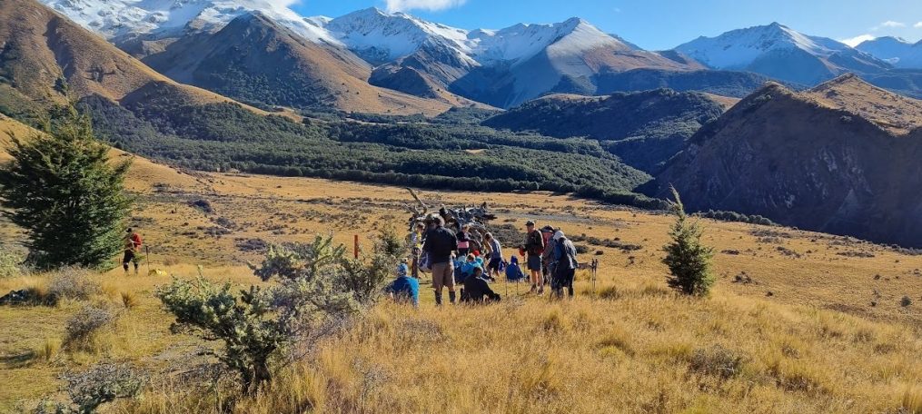
On a radiant spring morning we embarked on a lovely tramp to explore some of the captivating landscapes of Banks Peninsula. With 22° forecast promising a warm spring day (the previous 10 day average high was just 14.1), 44 enthusiastic trampers set out. Several trampers had returned from fantastic overseas journeys and Hetty was welcomed back after a difficult year.

The Standards consisting of 24 members set out from Morgans Valley to Lyttelton via Major Hornbrook Track and then on to Urumau Reserve, Evans Pass and down to Sumner. This route promised a day of elevation gain (and pain), panoramic vistas and a touch of wilderness magic. As they traversed the trails trampers were treated to the vibrant hues of spring blossoms.

Meanwhile the Alternates, a lively assembly of 20 members and visitors, opted for a slightly shorter yet equally scenic route. Their journey also led them from Morgans Valley, and then on to Urumau Reserve concluding in picturesque Lyttelton – where there was the opportunity for a well-earned coffee or ice cream.

Native flora was on display including these I’ve since identified (hopefully correctly): mahoe, kōhūhū, akeake, five finger, lemonwood, ngaio, red matipo and Coprosma robusta . While Banks Peninsula also supports unique fauna such as the jewelled gecko, forest gecko and spotted skink these little critters weren’t keen on making obvious their presence.

Both groups revelled in the fine weather and joy of shared experiences. Conversation flowed freely creating a sense of community. Laughter echoed through the valleys and friendships were forged amidst the beauty of Banks Peninsula. As the day unfolded, trampers in both groups marvelled at the diversity of the terrain — from lush forests to open meadows, rocky slopes to serene coastal paths.

The bus picked up the Alternates from Lyttelton and then the Standards in Sumner before heading back to base. The day’s tramp was not just a physical exploration but also a collective celebration of nature, friendship and the spirit of adventure that defines  Bishopdale Tramping Club.

Text by Brent (50%) & AI (50%)
McCormacks Bay – Evans Pass – Moncks Bay 20 September 2023

                                Leader Mentor Understudy Tail Ender
Standards Janice Bev Brent Ailsa
Alternates Ray B Norma Ali Min

Stats: distance 15km, elevation gain 676m, time 5hrs approx

Well! Your correspondent walked with the Standards today – and can’t possibly ever go back! It is just too embarrassing. Not only was an (unnamed) Standard wearing the same brand of new tramping boots, but they were also the same colour! The fashion clash was just too awful for words. Anyhow I managed to soldier on and kept up reasonably well with the pace set by the leader – Janice. Janice ran a good and very democratic ship. The democracy part did seem to be a little puzzling to some members with more authoritarian views. For instance one of the trampers was heard to shout “ecstatic” in response to a request on how did they feel if lunch was a little later.

Our group started off from McCormacks Bay gaining altitude at a breathtaking pace. It was interesting to note the chatter amongst the trampers dying off as the pace picked up. After some time, we arrived close to the top of Mt Pleasant and then descended to Evans Pass and finally on to Moncks Bay.

Some history about Redcliffs, McCormacks Bay, Evans Pass and Moncks Bay:

Māori used the Moa Bone Point Cave for shelter and the preparation, cooking and eating of food, including moa, seals, rats and shellfish. Areas within the cave appear to have been used for manufacturing artefacts of stone, bone and shell.

McCormacks Bay was named after William McCormack who arrived in New Zealand on the Charlotte Jane on the morning of 16 December 1850. He ended up buying about 50 acres (ca 20 hectares) of land in the area.

The road over Evans Pass from Sumner to Lyttelton was completed in 1857, and carried all traffic between the city and its port until the road tunnel was opened in 1964.

The first European owner of 100 acres (40 ha) in Moncks Bay was George Heath, who arrived in Lyttelton in March 1851 on the Isabella Hercus. He also had 500 acres (200 ha) of land on the hills behind.

Several trampers have let me know that they enjoy the trip reports. One even saying that he had to praise them because he didn’t want to do them!

The Sumner Steam Tram ca. 1904

Txt by Bill S

Peak Hill 13 September 2023

                        Leader Mentor Understudy Tail Ender
Standards Warren Janne Dave F Janice
Alternates Ray B Gavin Brent Soo

Standards: distance 9.5km, elevation gain 650m, time 5hrs

Your correspondent tramped with the “A” team today (aka the Alternates) along with 18 other souls. My earliest recollection of the tramp was reading the leader’s guide some years ago. What became etched in my memory was “a steady uphill climb.” Nothing at all about it being an “in your face grind with little relief.” Whatever, the views were as superb as the weather, with the brown tussock complementing the brilliant blue of the lake itself.  It was hard to imagine what it must have been like before humans arrived some 500 years ago and burned down the podocarp forest dominated by great trees such as totara and matai allowing tussock and scrub to take over.

The wonderful views evoked several wistful memories (wistful memories are one of the strengths of the Club). A memory, which was fit to print, involved one tramper as a 12-year-old on holiday near the lake paddling his kayak near the water intake of the power station and wondering why a whirlpool was close to his boat. When he looked up and read all the warning signs, he admitted to feeling rather chastened. The power station was one of the earliest substantial power stations in New Zealand. Currently (if you’ll pardon the pun!) there are five active turbines with two that are 100 years, or over, old.

By the way, Peak Hill itself is a roche moutonnee (or sheepback rock) which has been formed as outlined in the diagram.  This gives you an idea of the depth of the ice!

From the Standards: The views from the Peak Hill summit (1240 m) of Lake Coleridge and the snow-capped mountains beyond were great as usual but the wind meant we didn’t linger long to view them.  We dropped down just a short way to a nice sheltered hollow where we had lunch.

The next part of the trip from the summit down to the ‘corner’ where two fence lines meet and there’s a DOC sign saying ‘Peak Hill Conservation Area’ is a little bit rough underfoot as there’s no formed track and there are also many spaniard grasses to avoid (which not everyone did).  It was commented that it was much much easier than the descent from Boundary Hill however.  We made good time to the sign (about 45 min from lunch) and were there about 2pm.  At that point, we estimated we’d be back at the bus by 3.30 which proved about right. 

Note of thanks: As with virtually all BTC tramping trips the leaders, mentors and tailenders again performed an excellent job for which I for one was very grateful.

PS The much unloved spaniard grass is a member of the carrot family!

Txt by Bill S

Coalgate Forest 6 September 2023

Leader Mentor Understudy Tail Ender
Standards & Alternates Peter Evan Ali Marg E

Distance 9.5km; ascent 250m; time 4hr

Vice-president Jen was at the helm again this week as we headed out of Christchurch on a day that promised sunshine and warmth. Our total of 47 keen trampers included Ming-ming, a guest of Frank W, farmer Evan and four extra local trampers we collected at Darfield. Driver Alan drove us all happily onward and we didn’t stress about the forgotten grey sign-up folder, nor the forgotten instruction sheets that describe the tramp. Evan would save the day with his guidance! And again this year, we’d been given permission to walk through the no-longer-mined Bathurst area.

The happy drive continued until – shock, horror – we reached a locked gate at a point that was not in a friendly bus-turn-around position!  The key that Evan was given did unlock a bright yellow padlock but another padlock determinedly blocked access. A very resourceful team of Evan, Alan and a couple of BTC men worked steadily for around 20 minutes to completely lift the gate from its hinges. They used a metal bar (which snapped a couple of times), logs and planks of wood, the bus wheel jack, and oil and overall they provided quite an entertaining stop for us on the bus.

Our walk started only a short distance further on, but Alan was able to turn the bus around at that corner and we all tramped as one group for the day. Evan had explained that he’d been on the farm since 1972 and was hoping to retire very soon. Coal mining by Bathurst stopped two years ago, but the process of remediation of the land and complying with all the requirements of Selwyn District Council and ECan means that the process of final sign-off and closure could take many years. At our morning tea stop by the manmade lake, we met Andy (our farmer guide from last year) and admired the stability of the hillsides that had been developed as well as the colourful rock waterways. Rayonier Matariki Forests have already planted some trees, but the timing of consents about where trees may be planted is making progress slow. In addition, there is a proposal to set up a covenant in perpetuity that includes native tree planting areas and a specific predator-free lizard reserve area. Native lizards apparently live in the area – though we saw none at all! All this has very complicated implications for landowners and most of our trampers agreed we were quite happy to be city dwellers.

We also saw the solar powered water measuring station that allows ECan to remotely monitor the purity of water run-off from the hillside. This water flows into a stream in the area that is home to the critically threatened kōwaro/ Canterbury mudfish.

After the ex-mine section, our tramp continued over a fairly familiar route, mostly on 4WD type farm roads and after an energetic climb we enjoyed a very pleasant lunch spot at 12.15pm with magnificent views in all directions. After lunch, as we climbed higher and traversed the farm’s hilltops, we battled a classic nor’westerly wind patch that made tramping very unpleasant for around 20 minutes.

Progress was steady after we descended out of the wind. Evan provided the magic key to unlock a deer fence gate that blocked our way and we continued down beside patches of trees, under and around fallen trees and eventually to a “new” fence crossing into a final paddock that led us to the waiting bus in Farr Street, Whitecliffs. It was another good day of non-technical tramping, with great views, and not marred too much for two or three trampers who found they had missing or empty shoe-bags at the bus, or poles nearly left behind, or a dropped car key discovered (thankfully) by driver Alan. And we even had time for a refreshment stop in Darfield as we dropped off the crew of extras. Most of us were home by 4pm.

Text by Janne R

Mt Thomas 30 August 2023

                   Leader Mentor Understudy Tail Ender
Standards Glenys Tony G Jen C Shirley
Alternates Ali Norma Gary G Kiwan

Distance 10.8km, ascent 790m, time 5hrs 25mins

Mt Thomas had been scheduled for 2nd August but was cancelled due to the weather so you may have heard a collective sigh of relief from trampers as the chance to summit was gone for another year. Not our fault, beaten by the weather. It has been a few years since we have reached the jumble of meteorological towers and large trig on top but always with a legitimate reason of course, rain setting in, gale force winds, excessive cloud obscuring the view or running out of time.

With a good forecast, 16 degrees, light winds 29 trampers which included one new visitor Lisa and driven by Callum we left Bishopdale with one pickup, Glenys at Ohoka Road. We were all busy chatting as we do when some realized we were heading in the wrong direction, west to Rangiora Airport. A quick turnaround saw us back on track soon turning in to Hayland Road where lambs either side were frolicking in the fields before our stop at the picnic area of Mt Thomas Forest Park.

We set off at 9.50am with the Standard’s plan to reach the top by the most direct route – the Summit Track. We climbed a stile before heading uphill through pine forest. After approximately 20 minutes and having climbed over a large pine tree across the track we reached a logging road. Here in hindsight, we obviously went astray as instead of crossing the road and continuing up an even steeper track we followed the road to our left and found we were heading rapidly downhill into beech forest and losing all our elevation. Thankfully the track did start to rise again to lift our spirits and at 10.25am we stopped for morning tea. At this point one knowledgeable tramper advised we weren’t on the Summit Track. It was agreed we would push on with our current track. Shortly after smoko we reached a signposted junction and learned we had indeed been on the Forest Track and were now joining the Wooded Gully Track. This was mildly concerning as we were aware from Marie-Therese’s pre-tramp website research that there was a DOC warning about a slip on Wooded Gully Track. We hoped it was behind us on the un-walked track.

The beech and podocarp forest with ferns and lots of streams some with bridges is stunning but concentration is required with tree roots and rocks underfoot. The track fools you with steady ascents followed by steep descents so you feel as if progress is minimal. Approximately two thirds of the way up now climbing more rapidly we suddenly came to the very large slip! Two sections of tape across the track had already been broken. Everyone stood in silence for a few seconds before we had a discussion on whether to proceed. I think we all thought we had come too far to go back so voted to continue but not without some trepidation. From where we stood we could see the continuation of the track on the other side. One surefooted tramper had already negotiated the slip via a high route and informed us we could rejoin the track. Being health and safety conscious we chose the lower route, climbing over under and squeezing our bodies between trees to cross the slip and scramble up the bank of clay mud and rocks hoping it wouldn’t give way. With only six men for ten  women we couldn’t expect them to carry us over the slip but they did lend a helping hand to pull us up the bank.

At 13.05pm after the final uphill slog at last we came out of the forest to bright sunshine and 10 minutes later we chose a spot in the tussocks with patches of snow to enjoy a well-deserved lunch. A handsome young deer stalker walked by with his bow and colourful arrows. It was just a brief chat, not even time to get a photo as we were obviously not his target.

Now fully nourished we walked along the ridge with snow melt adding to the very boggy muddy condition of the track. There had been several slides earlier especially when negotiating the slip and one nose dive into the mud on this section but because it wasn’t witnessed no need for any more detail.

The views at the trig were magnificent with the Canterbury Plains one direction and the glistening snow covered Southern Alps in the other. A woman from a group of young friends who had climbed the Summit Track kindly took our photo. She asked about ways to descend as she had seen on the website that the Wooded Gully Track was closed. We were able to inform her the oldies had made it over the slip so they should have no trouble.

It took us 1hr 35mins on the Summit Track to be back at the bus by 15.15pm. An ideal way to descend quickly but all agreed we were pleased we had not stuck with our original plan to go up via the Summit Track when we saw how steep it was.

The Alternates had also hiked up the Wooded Gully Track and had stopped for lunch before the slip.  On their return they had branched off to join the Summit Track back to the bus arriving at 14.30pm.

Back at Bishopdale before 16.30pm after a fantastic day in perfect weather with everyone intact after an unplanned adventure.

Well done Glenys, a good advert for “Girl Power’’.

Txt by Kate

Charteris Bay to Purau 23 August 2023

Leader Mentor Understudy Tail Ender
Standards Dave B Wendy A Sally Veronica
Alternates Les Leonie Moira Tessa

Distance 12.3km; elevation gain 425m; total time 4hr 40min

An incident free day is a great summary for this early spring walk. The Coastal Cliffs Walkway follows the foreshore between Church Bay, Diamond Harbour and Purau, with harbour views and forms part of the Head to Head Walkway.

Acting President Jen welcomed visitor Linda M for a further outing, noted Basil’s return after an absence, also Eric from his and Margaret’s recent overseas trip. The 43 trampers and driver Viktor gratefully received Bill S’s birthday treat, hands delving into the brown paper bag.

The Coastal Cliffs Walkway site indicates the possibility of small slips and debris across the track with steep cliff edges in places, noting that the track can be slippery. The track was indeed slippery, and muddy, and when the 26 Standards crossed paths with the 17 Alternates at the Diamond Harbour domain there had been a few minor slips. The Standards had walked on inland rural and urban roads via Purau to the lunch spot.

Meantime as the Alternates walked around the coastal track, we idly imagined ourselves in distant places, Italy or Spain. We admired luxurious houses, the wildlife and listened to the bird song. It was a little tricky to be looking at the view, flora, and the properties while keeping a good foothold on the track and maintaining a good conversation. Among the plantings were tall blue spires of echium, euphorbia , tree lucerne, wallflower, geranium, tree aenoium (with the bright cone shaped yellow flowers), South African salt bush, buddleia and the ubiquitous eucalyptus and pine trees.

A large group from the Over Forties tramping club hailed us as we encountered them, covertly took photos of the opposition, though promised these would be made available.

Birdlife that might be heard, or seen, included the grey warbler, pīwakawaka/fantail, welcome swallow, and kererū/wood pigeon. There is also the possibility of spotting a kiwi on an alternate Bayview Road route, albeit a shapely topiary model. (Sightings by some dedicated BTC members who had walked the 14 km three days earlier.)

Following lunch the Standards returned along the coastal track to their pickup point at Charteris Bay. The Alternates carried on for a short time towards Purau, truncating their walk due to time restrictions and the lure of the nearby café/ice cream shop. Before long the Alternates were back at Diamond Harbour, wearing clean footwear, enjoying refreshments and relaxing in the sunshine. But not before one keen walker paced up and down the footpath to ensure that a bare 8km goal had been achieved. As the bus neared Charteris Bay, the Standards were finally sighted, a long line of walkers stretched out along the road, nearing the end of their 12km walk.

We returned to Bishopdale around 1600 hrs, having enjoyed this good day out, appreciating our surroundings and the ability to do our walks, one step at a time. From one tramper’s conversation, “Tomorrow, and tomorrow, and tomorrow, Creeps in this petty pace from day to day…” (Shakespeare, Macbeth)

Text by Marie-Therese

Hinewai Reserve 16 August 2023

Leader Mentor Understudy Tail Ender
Standards Jan Br Alan H Warren G Ailsa S
Alternates Bruce D Leonie D Ali M Marie-Therese Mc

Alternates’ Distance: 11kms, ascent: approx 500m, time: 5hr

As we gathered at Bishopdale for the trip to Hinewai there were a few blurry eyes from some members due to the 8.00am start. The weather is always a topic of discussion when trampers gather and it was no different today. Were we going to beat the forecasted southerly change due late afternoon? More about the outcome later.

With driver Alan and the Halswell contingent on board the 42 trampers headed out on the two hour journey to Hinewai. In the absence of President Judy, Vice President Jen C acknowledged the resignation of member Eunju, welcomed new member Lynn B, visitor Linda M and guest Kathryn L. The ride to Hinewai has a variety of scenery with farmland, Lakes Ellesmere and Forsyth, the Hilltop, beautiful bays and the steep climb up Long Bay Road making an interesting trip.

Both groups (Standards 26, Alternates 16) set off at 10.20am on the Kereru Track in fine but cool conditions. Once in the native bush we were able to witness the extensive damage that the December 2021 storm had caused. The track was badly damaged and a number of bridges had been washed out. Some repairs had taken place but it is a huge job and will take months to finish. There were a few slips and slides but everyone negotiated the track without injury.

Hinewai is now a 1250 hectare reserve. The initial purchase was by the Maurice White Forest Trust in 1987. It is rich in native trees and we saw some beautiful kahikatea estimated to be 600 years old. The reserve has been looked after by the eccentric Hugh Wilson and his exploits would fill a book. Pest control is an issue in any native reserve and Hinewai has been working hard to control the introduced aliens. Pest control workers were on the track when we walked through. For more info on Hinewai go to:   www.hinewai.org.nz

The two groups arrived at Woodcutters Clearing at the same time after the Standards weren’t able to follow the track to Fantail Falls. Both groups had lunch at Ōtānerito Bay in fine but cool conditions. The Standards were first to leave and the Alternates followed shortly afterwards. The Valley Track hadn’t suffered the same damage and it was an easier 500m ascent to the Visitor Centre and bus.

The Standards were first to arrive back and were safely in the bus when the hailstorm arrived. However, the Alternatives were caught out and had about a 30 minute dash through the storm. Arriving back at the bus we quickly removed coats and boots for the sanctuary of a warm bus.

It had been an eventful day but it was great to return to Hinewai after several years and although a dunking everyone soon warmed up and looked back on another great tramp. Many thanks to Alan our driver, he did a fantastic job ferrying us back to Bishopdale in difficult conditions.

Text by Ray B

Bridle Path-Pony Point-Stan Helms 9 August 2023

Leader Mentor Understudy Tail Ender
Standards Brent Chris S Cath L Jan M
Alternates Ali Liz S Gary G Moira

Distance 13km; ascent approx 400m, time 4.5hr

On the bus ride Bev again took on the role of president in Judy’s absence.  Bev welcomed returning visitors Lynn B and Stuart C, new visitor Linda M and Mei a guest of Min and Janne. Callum was our driver. On arrival at Heathcote and having connected with trampers who had travelled independently we were 45 strong.

It was another great day’s tramping with sunny skies and no wind. To set the scene, a bit of background about Lyttelton Harbour. The harbour was part of a series of volcanic eruptions about 6 – 11 million years ago (which is about as old as I felt the morning after the tramp), the first occupants were Waitaha followed by Ngāti Māmoe from around 1500 AD. Ngāti Māmoe were in turn followed by Ngāi Tahu in the 18th century. Banks Peninsula was spotted by Captain Cook and his crew in HMS Endeavour in 1770 (who thought it was an island). The first European inhabitants were probably sealers visiting at the beginning of the 1800s. The first four ships arrived at the end of 1850, while amazingly, the Lyttelton rail tunnel was opened only 17 years later in 1867.  The road tunnel following 97 years after. (https://www.lpc.co.nz/about-us/history/)

A little known fact about Lyttelton Harbour was the sinking of the fishing boat “Dolphin” in the early days of WW II by the harbour’s shore battery defences. The situation leading to the sinking was as shambolic as it was tragic. The shore battery staff saying the boat had ignored their signal to stop while the fishing boat survivor saying they saw no signals that were addressed to them. The “warning shot” from the shore battery hit the fishing boat sinking it, and mortally wounding the skipper. (https://www.flickr.com/photos/archivesnz/10044887175/in/photostream/lightbox/)

In terms of the tramp, it was quite a work-out. In effect it was up and over the Bridle Path twice. As ever, different people handled it in different ways. For instance above the rattle of my lungs gasping for oxygen, I could hear other trampers chatting away merrily. Clearly not at all stressed by the stroll. The other “hot” topic of conversation was about the set of legs on one of the males wearing shorts. The owner thinking they were best described as “gorgeous”! I should hasten to add that not everyone else agreed. However, this still lead to one of the younger ladies fantasising that he was probably wearing blue and white striped “Speedos”. Fortunately at that stage the group spotted someone swimming in the sea and this cooled the conversation down no end.

The Latest Carving at Pony Point Gorgeous Legs..?

All in all an excellent tramp which was well organised and led. With a special thank you to the Weather Team who got it right again.

Text by Bill S

PMH – Huntsbury 26 July 2023

Leader Mentor Understudy Tail-ender
Standards Dave R Chris Bev Jen
Alternates Ali Liz S Joanne Min

Distance 14.6km; elevation gain 600m; time 3hr 45min

Having volunteered to be diary writer this week and with the change of tramp, I’m semi repeating the same role as a year ago, albeit that ending was Bowenvale. It was tempting to simply provide reference to the 2022 effort. However a different combination of people and stories plus avoiding temptation has necessitated a rehash (and some different history). The earlier report contains information about the Cashmere Caverns.

“The Port Hills of Christchurch” (Gordon Ogilvie, 1978) has an outstanding record of this area and is available at the Christchurch Library. http://www.mapspast.org.nz/ is another source of maps from the 1870s which shows the urbanization of the Port Hills over the decades.

43 hardy trampers (visitors Frank, Jonathan, Lynn and Stuart) set out into the cold, windy SW morning. It was a very good call by the weather team as the writer’s night had been spent checking for a cancellation email. The early characters of Christchurch climbed along a Māori trail to the saddle known as Pukeatua. The trail then cut downwards to Governor’s Bay through the property of local farmer John Dyer, who assisted with feeding the surveyors and engineers, and giving advice to the Provincial Government. Mr Dyer was rewarded by having the route named after him. Today after Viktor deposited us at Princess Margaret Hospital 24 Standards set off like a pack of unleashed greyhounds, while 19 Alternates followed the Trip Notes at a slower pace, up, down and along a series of streets and tracks.

Hats, gloves and parkas were shuffled about through the day to cater for the exposed areas. Fortunately as the clouds, kilometres and time passed, it became almost pleasant in the sunshine, especially when out of the wind. Alternates stopped for morning tea at Cracroft Lookout with views to the distant snow covered Southern Alps. Unfortunately Norma’s merino beanie was whisked away by the wind, into the treetops below the lookout. Norma continued stoically on, eschewing all offers of alternate headwear. Standards continued a bit higher for their first break.

An executive decision was made by Alternates’ Leader and Mentor to avoid a potentially muddy area of Harry Ell Track by walking a section of the road to Latters Spur. This deviation saw many of us for the first time, briefly passing the Memorial to the 19th Infantry Battalion and Armoured Regiment (1939-45), honouring the memory of those who died. Among other places the 19th served in Greece, Crete, North Africa and Italy.

Later as the Alternates sat lunching, nestled in the lee of the hill, the Standards were spotted descending the tussocks on a knobby hill below Sugarloaf. By this time almost everybody was a bit mud splattered – boots, legs or overtrousers.

There were also a couple of attempts to sabotage the tramp. The Standards told of being led onto a boggy trail which in turn became a muddy, steep track. This saw several people including Jaki and Janne coming to grief, slip sliding away, with a later disclosure of muddy bottoms and how long it took for undergarments to dry out. The Alternates’ Leaders were challenged by Ray who was pretty sure that the Huntsbury Track went down a more distant ridge below Mt Vernon. Fortunately Ray conceded that his recall of the route related to a different tramp.

The final push down Huntsbury Avenue to the waiting bus saw the Alternates arrive about 1330 hrs, closely followed by the Standards. A quick change to clean footwear, with most walkers opting for the short downhill walk to the Brickworks Tavern for refreshments ended this unexpectedly enjoyable winter outing on the Port Hills.

Text by Marie-Therese

Leith Hill 19 July 2023

Leader Mentor Understudy Tail-ender
Standards Tony Warren Janice Wendy
Alternates Nola Lynley Ali Soo

Distance 10.2km; elevation gain 873m; time 3hr 45min

Wednesday’s trip was enjoyed by 40 trampers, including four visitors Jonathan, Stuart, Frank and Lynn, and guest Mei Tan. We were looking forward to what many members consider their favourite hike – not too long or high, including a variety of terrain and scenery and with the expectation of great views over Castle Hill Village and beyond, at our lunch stop. Allie, the baker of our fabulous club birthday cake, had individually wrapped pieces for us to enjoy on the trip and these were passed around the bus with much oohing  and aahing. Thank you Allie.

Arriving at our destination we quickly assembled into our two groups and set off by 10.20. The beginning of the walk is along the Hogsback Track and having walked this twice already this year its familiarity led to the Standards overshooting the left turn onto the Water Intake Track. There were those familiar enough with the route and actually paying attention to reel in those at the front, and not too much extra ground had to be retraced.

As always the chatter is interesting and on this occasion the focus was on the ChatGPT app and what sort of write-up it would produce were it utilised for the trip report. (As you read on you can decide – artificial intelligence or just sub-intelligence on display here). Those within earshot were surprised to hear that one of our members, a cheery fellow and seemingly in good health, had provided very minimal details and asked the app to write his obituary. He professed to be delighted with the outcome! At morning tea this week’s diarist discovered that she had failed to bring something to write with, which was okay because she also had nothing to write on. At this point the decision was made that if it turned out at the end of the day that the trifecta had come in with nothing to write with, on, or about then perhaps AI was a good option.

A number of walkers remarked on the birdsong which was abundant throughout the bush. What a great sign that the pest control is working. Breaking out above the tree line we could see ‘the slump’ not too far away and as we got closer, our Alternates came into focus enjoying their lunch stop.  Unsure whether they had taken a different route, or we had lost more time than we thought, Nola had her team up and off not long after we joined them. Those who completed this tramp the previous year reminisced about the vastly different conditions and how in 2022 they had been lunching in snow at this point. Apparently errant belongings having to be chased down the slope, and makeshift toboggans had provided good entertainment.

Setting off for the second part of the day highlighted the ‘walk of two halves’ nature of this outing. Out in the open but with slippery vegetation under foot and plenty of matagouri to punish those in shorts and short sleeves, care was required. The standards were soon spread out as the track disappeared and everyone charted their own course down the hill. Two fences had to be negotiated and as always someone produced a cover for the barbed wire allowing a safe crossing. On this occasion one of our group noticed the sagging nature of the No 8 wires elsewhere and slipping through this way turned out to be a better option. NB it is advisable to remove one’s pack before attempting this manoeuvre. However, not doing so does provide much amusement for the bystanders.

Circling around the back of Kura Tawhiti one cannot help but be impressed by these magnificent limestone formations. Were any of us thus motivated to take up rock climbing? I suspect not.

Kura Tawhiti means “The treasure from a distant land” and is an allusion to kumara cultivation in the area. Most of us associate the word kura with the word for school, but knowing now that as well as knowledge it also means treasure, it makes sense. Just before the car park, were three pou (carved posts) accompanied by excellent explanations of their meaning, and the significance of this area to Ngāi Tahu. Well worth studying.

Arriving at the bus, we rejoined the Alternates. Several of them commented on Nola’s leadership and what a great job she’d done. A big thank you to Nola and everyone else who assumed roles for this hike. Once Allan had us underway, came the moment of truth. Those of the personality type able to postpone gratification, carefully unwrapped their cake sausage, much to the envy of those who had consumed theirs at the beginning of the day. Fortunately, President Jude announced there would be time for refreshments at Darfield which was welcomed by all. With many members embarking on travels it was Jude’s turn to be farewelled as she’s off to visit family on the other side of the world. We look forward to your safe return, and tales of your adventures, Jude.

Text by Jan Bw