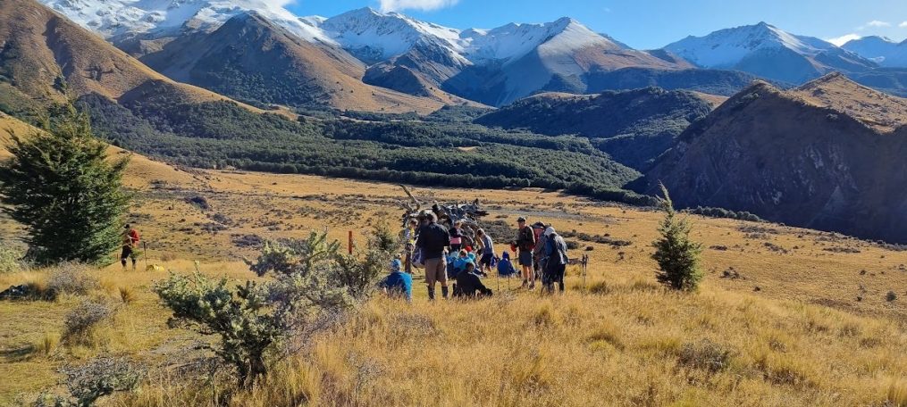
Otoromiro_Christmas Lunch 13 December 2023

Sadly the weather on the hills was forecast wet, making hill walking slippery underfoot so we forewent our planned pre-lunch walk.

As in the two previous years we had booked our end of year/Christmas lunch at Ōtoromiro Hotel. Sixty people lunched including several long-standing members of the Club who have recently resigned, and our treasured driver Viktor. Thank you Viktor for the  festive manuka honey and ginger lollies.

Happily the sun made an appearance after we’d finished lunch so we took the opportunity to walk out to the end of the jetty. By 2.45 pm we were on our way home to the city.

Text by Jen C

Mt Grey 6 December 2023

Leader Mentor Understudy Tail Ender
Standards Bev F Graham Brent Shirls
Alternates Ray B Gavin Ali Min

Distance 11.5km, vertical ascent 665m, time 4hrs

The 22 Alternates did not need the digitalis in the lovely foxgloves lining the path to get their heart beats up as leader Ray led us up through the slash and on to the trail headed up Mt Grey. For those of us who were under the belief that this was an easy trail (including Jacqui D, completing her third visitor tramp), we were in for an awakening. We quickly discarded jumpers and other extra clothing.

Ray allowed a few breaks before our stop for morning tea, albeit tea was before the lookout which has been the goal in the past. Two morning tea breaks is not necessarily a bad thing, and we were challenged by a non-BTC tramper at the lookout to meet him at the top.

And meet him we did, arriving at the top by noon for spectacular views across Ashley Forest. We were followed shortly by our driver Viktor (who had stopped the bus on the shingle road to rescue an extra set of keys to the bus from the wheel well left by an earlier driver). About mid lunch break, we saw the 19 Standards lead by Bev winding their way up the hills. Not wanting to be passed by them on the way down (and because we had been there 30 minutes), we quickly concluded lunch and then formed a “military sword salute” with our hiking poles to recognize the Standards’ sweaty faces as they arrived. Well, most of them were honoured as we could only wait so long.

Per a source in the Standards, nothing happened worth reporting on their tramp.

The only reminder for the Alternates was that the trail was as steep on the way down as it was on the way up. Fortunately, only a couple of tumbles occurred in the slippery mud spots, and we all arrived at the bus in good shape.  The Standards arrived within 30 minutes, and we were off to Bishopdale after a short stop requested by Judy to allow two hitchhiking bees to escape the bus and continue their pollination activities, arriving back in Bishopdale by 4pm.

Text by Michele S

Mt Barossa and Lake Clearwater 29 November 2023

Leader Mentor Understudy Tail Ender
Standards Brent Janice Graham Frank W
Alternates Ali Alan H Michelle Sally

Standards:  distance 7.3km; duration 4hrs 30min (approx); vertical ascent 824m

Alternates: distance 10km; duration 3 hrs

Alan was our driver picking us up at Bishopdale at 8am. There were 43 of us on the bus including visitor Jacqui and guest John. The Alternate group was walking around Lake Clearwater for the first time, rather than up the Stour River as in 2022.

The 13 Standards were laughing nervously at the start as we were wondering if you lot were being much smarter than us! But I don’t think any of us regretted doing the Barossa option. Yes. It was just up up up all the way to the top, and we were in thick fog almost all the way from morning tea. And so cold after lunch we had to dig out all our almost-forgotten items from the depths of packs, like zip-off pants bottoms and neck warmers.

But there were plenty of highlights too: the incredible limestone tors at the top, singing a silly song together on top of one of those massive rocks, the gorgeous shards of quartz rock in pretty pastels lying around like discarded treasure,  the delightful tiny sub-alpine flowers, witnessing from afar the hundred head of black cattle complaining loudly as they held up the traffic and leader Brent’s wacky idea to march (supposedly in unison) back to the bus!

Text by Shirls

After dropping the Standards at the bottom of a mist-covered ridge the Alternates sat on the bus for long enough for there to be some ‘Are we there yet?’ moments. We reached Lake Camp/Ōtuatari and some of us mistaking it for Lake Clearwater/Te Puna a Taka were surprised. It is a very small lake. Would we do several circumnavigations? Others knew it well, from earlier water-skiing days. It is the only lake in the area where powerboating is allowed.

There’s a cluster of fishing baches on the shores of Lake Clearwater. Brown trout apparently. And it’s a pretty walk around it. Sadly the lake’s future may not be so pretty. Without urgent action its imminent death has been heralded (David Williams, Newsroom, 18/02/2023). There are indications that due to land use, cow numbers and intensive farming, the lake could be flipping – transitioning from a clear, macrophyte-dominated state to a turbid, algae-dominated state. However over the past two years this transition has been slowed by ECAN and local landowners working together to encourage relocation of winter grazing to lower-risk areas, fencing waterways to restrict cows’ access and farming sheep.

On a happier note, the lake is also home to bitterns, wrybills and after receiving votes from a global fanbase Forest and Bird’s 2023 Bird of the Century the Pūteketeke or Australasian Crested Grebe.  Thanks for its newly acquired celebrity status in large part go to John Oliver. Some of us were out to spot a nesting pair. We didn’t. The closest we got was a sign describing them.

Pūteketeke signage

The wait in the bus for the Standards on our return was short and filled with speculation about who was who as we watched their descent. What happens on the bus stays on the bus. Despite not seeing the now famous bird, it was a fun day out and we were home shortly after 5pm.

Text by Jen C

Annavale – Sugarloaf – Benmore Hut – 13 Mile Bush 22 November 2023

Leader Mentor Understudy Tail Ender
Standards Dave  R Chris Brent Janice
Alternates Ray Norma Ali Moira

Distance 14.4km; duration 5hrs 30min (approx); vertical ascent 577m

Now before anyone gets the idea that this was an easy little toddle on the Port Hills, you should know the Sugarloaf in question is not the Christchurch one with a tower on it. It’s not the one near Motueka, nor the Otago one either. Sugarloaf just happens to be a popular name for many nice rounded hills. No, this tramp was a bit tougher than the Port Hills one, and far more interesting too.

Our two groups totalling 45 trampers including visitor Mijung, set off from Benmore Station carpark just before 10am. Let’s be honest, that farm track towards the hills seems to go on forever. At least the stream crossings were a bit more fun – especially when one of the Standards bounced over the surface like a skimming stone, before the inevitable ‘plop’ of going down (I heard an Alternate had a bit of a splash too).

It was getting warmish as we made our grunting-grumbling way up the steep Annavale track, which made stopping for a late morning tea with glorious 360 degree views all the more appreciated. When we got to the signposted junction it was good to know we weren’t taking the track up Sugarloaf, but rather the one on the right towards our goal, Benmore Hut. A shorter distance, and through rather nice bush, but with its own challenges. Especially the really steep downhill bits just before lunch – these were best negotiated with a low centre of gravity, whilst hanging onto handy little trees growing close to the track.

The best thing about the Benmore Hut is that you can’t miss it when you’re getting close. Whoever decided this rustic, easy to find hut should be painted in almost-fluoro orange must have had a good sense of humour. It is certainly located in a lovely spot, with plenty of shade perfect for cooling down as we ate our hard-earned lunch (no pesky wasps or Over 40s trampers this time!).

Downhill after lunch – sounds ideal if not idyllic. And the track through the beech forest offered lovely dappled light, a little birdsong … and lots of mud. It was interesting to see the many predator traps, including the new really high-tech ones. Even better was seeing that there was a very dead black possum caught in one of the older traps.

How many heads got bumped on the low hanging branches?  Only two that I observed, but there were most likely others (not me this week, tee hee!). Then there were all the tree trunks lying across the track which had to be climbed over (going under was fun too). And how many people slipped over when we constantly had to cross over the stream? – a few.

As for the return journey on that terribly long farm track we had traversed in the morning? Well, it seemed twice as long on the way back to the bus. It was 3.30pm when the weary Standards made it to our flash bus waiting back at the farm carpark, along with our driver James. By then the 17 Alternates had been waiting for an hour and a half. They too had had their fair share of steep uphill farm track walking, steep downhill farm track walking, rough tracks through beech forest, as well as lots of stream crossings (I did hear that they had also enjoyed two morning tea breaks, but that’s just a rumour).

After being undertaken three times by our club now, this tramp has likely earned its place on our yearly calendar, with its varied route and just enough challenges to stop us feeling we’ve easily mastered it.

Text by Shirls


Awa Awa 15 November 2023

Leader Mentor Understudy Tail Ender
Standards Lynne R Dave R Jon B Ailsa
Alternates Les G Norma Gary G Eric S

Distance 12km; duration 4hrs 45 min (approx); elevation gain 630m

The 44 trampers booked for Awa Awa (including visitor Mijung) equalled the number in 2023, but it was hoped that that was where similarities between the two tramps would begin and end. President Judy welcomed all, and the ever-reliable Victor had us at the Reserve, and ready to walk by 10.15am. This despite him parking the flash newer bus on the roadside, out of harm’s way from the overhanging trees. We were grateful for the extra 50 metre warm-up as it was almost straight into the steady climb with little time for the lungs and legs to adjust.

A layer of misty cloud overhead did not dampen spirits and there were the usual interesting snatches of conversation and laughter to be heard as we made our way upwards. Despite perspiration making inroads on the SPF, a further application was not necessary as only glimpses of the sun were seen during the day. Before too long, brief halts were called as layers had to be discarded despite the cool conditions.

The 31 Standards were ably led by Lynne R who maintained a steady pace. When we eventually reached the saddle, the clouds swirling up and over us confirmed it was not going to be the day to capture great shots of Mt Hutt, or the Canterbury Plains. On reaching the top, which coincided with the lunch call, we found that we did not have the place to ourselves. Not one, but two other groups were already dug in, and looking unlikely to relinquish the favoured dining spots. On hearing that one of the groups was the Over 40’s Club, one of our number happily announced that we were the Bishopdale Under 40’s! “Oh, if only” we all thought!

As usual, the descent was much more hazardous with the dampness underfoot providing plenty of opportunities to slip. When one of our number eventually came off second best in this “tramper versus terrain” tussle, there was a collective held breath until the thumbs up was given. In the meantime, the Alternates were a smaller group under Les’ leadership. Les had his first walk with the Club on this tramp in 2022. Both groups had a very enjoyable day in the Canterbury high country.

Research tells me that the McLennan family settled in the area around the 1880s when Alexander McLennan secured a position managing the 36,000 acre Blackford Station. A whole other story is that he managed this feat, without feet, having lost them to frostbite! He built a home in the bush and hence the name, McLennan’s Bush. The rhododendrons were first planted in 1968 with The Awa Awa Rata Society being formed in 1970 to maintain a rhododendron park. Shrubs continue to be planted and it was a pleasure to see the bushes, some still in full bloom. It is generally acknowledged that rhododendrons originated in the Himalayas, so no wonder they looked at ease in today’s temperatures. For those who think such botanical beauty should grace the gardens of a stately home, well … you’re just going to have to make do with the very impressive new toilet block.

Author’s note to self … in future on arrival at Bishopdale reconnoitre the carpark fully and do not pull into a space next to the President. It makes it too easy to be bushwhacked – i.e. asked to do the trip report!

Text by Steve Bw

Sign of the Bellbird/Kiwi to Evan’s Pass 8 November 2023

Leader Mentor Understudy Tail Ender
Standards Janice Warren Sally Margaret E
Alternates Ray B Norma Ali Tessa

Distance 17km; duration 5hrs (approx); vertical ascent 410m

On a cool November morning, 48 trampers, including visitors Lisa W and Jacqui D, boarded the bus at Bishopdale for our Sign of the Bellbird/Sign of the Kiwi to Evans Pass tramp (the reverse of January’s tramp). Our driver was Callum.

A quick trip through town, up Dyers Pass, and then over to the beautiful new lookout to drop off the 29 Standards. The lookout is named after John Jameson, the grandson of Harry Ell. During World War II, the reserves Mr Ell helped establish were grazed and the rest houses fell into disrepair. Mr Jameson championed the formation of a society to protect and expand on his grandfather’s legacy and was a leading figure in the Summit Road Scenic Society for nearly 70 years.

Sign at new John Jameson Lookout

The Standards departed the bus and had morning tea at the Sign of the Kiwi at 10:35. Janice was described as “off and away” which suggests the tramp moved along with pace. Lunch was just before Castle Rock above Horotane Valley and out of the wind. A few stumbles occurred on the tramp, but no serious injuries (nor names). Finally, recognizing that the Standards are older, Janice made sure all of them crossed the road to the bus safely once they got to Evans Pass (I did not make this up; it was reported to me in those words by a Standard walker).

The Alternates also moved speedily with leader Ray setting the pace. For the most part, we eschewed walking on the road, choosing to traverse the hills. Lunch was at the top of the Bridle Path out of the wind, after which most donned more clothes as the wind had picked up. The ascent to the base of the Gondola top station building led to a break to remove most of the extra clothes. We continued through herds of sheep, past the gun emplacements and finally down the long hill to the bus.

The most common word from trampers as they boarded the bus was “long” usually followed by “but a good walk”. The rain held off and the sun came out. What more could you want.

Information about lookout courtesy of Warren Gregory.

Text by Michele

Mt Vulcan 1 November 2023

Leader Mentor Understudy Tail Ender
Standards Peter Lynne R Jan Br Judy
Alternates Ali Ray Michelle Moira

Distance 14 km, elevation gain 609m, time 5 hrs

Dear Fellow Adventurers,

I hope this letter finds you well and filled with the spirit of exploration. As the sun painted the sky in hues of blue and gold and the warm breeze whispered tales of distant landscapes, I found myself compelled to share the awe-inspiring experience of our Mt Vulcan hike in North Canterbury.

Firstly, let me express my sincere regret that the trails we traversed are not open to all trampers. This was an exclusive expedition – on private land with restricted access – a privilege afforded to us by the Bishopdale Tramping Club – many thanks to our friendly farmer. We were 50 strong, driven by Alan and we welcomed new visitor Mijung.

The Standards, a spirited group of 33 trampers, embarked on a journey that unfolded like a tapestry of New Zealand’s finest landscapes. Our undulating tramp led us over expansive farmlands and meandering tracks, a symphony of rural charm under the vast sky. Outcrops of bright white limestone were many. As we steadily climbed, anticipation of our carefully chosen lunch stop hung in the air, a moment of respite before our ascent to the top of Mt Vulcan – where our intrepid leader chose not to yodel on the mountain top!

At the top a visual feast awaited us—rolling hills adorned with lush greenery, azure coastline extending to the horizon, and the distant silhouettes of majestic peaks. The summit was not just a physical elevation; it was a pinnacle of shared achievement and appreciation for the beauty that our efforts had unveiled.

The Alternates, a group of 17 intrepid souls, embraced a different but equally enchanting path. Sidling around Mt Vulcan, they ingeniously avoided the challenging climb to the top. Their journey was no less spectacular. The landscapes they encountered, the valleys they traversed, and the unique perspectives they gained showcased the diversity of our exclusive tramping experience.

While low cloud obscured Motunau Island for most of our walk, the cloud did eventually lift  sufficiently for us to see its lower half. The steeply-sided island is about 300m x 100m rising to a distinctive flat top 25m above sea level. Geologically it consists of Tertiary rocks, capped with loess and gravels and is surrounded by eroding cliffs and wave-cut reefs. A nature reserve, it is a breeding site for several species of seabird including the threatened little penguin/kororā,

As I write this letter, I can’t help but want to encourage you to seek out your own tramping experiences. While Mt Vulcan may be a closed chapter for now, Canterbury is filled with hidden gems waiting to be explored. The Bishopdale Tramping Club has shown us the magic that can happen when a group of like-minded individuals comes together to explore the wonders of our province.

So, fellow adventurers, don’t miss out on the magic. Either find your own tramping experience, and may your trails be as breath-taking as the one we forged on a fine November day to Mt Vulcan – or join the Bishopdale Tramping Club to experience what we do every week!

Yours in the spirit of exploration,

Brent M – with the help of my increasingly trusted ChatGPT friend


Bealey Spur 25 October 2023

Leader Mentor Understudy Tail Ender
Standards Chris S Jan Br Warren Brent
Alternates Ray B Norma Ali Les H

Distance 12.5 km, elevation gain 650 m (approx), time 4 hr 45 min and 5 hr 20 min

A club walk up Bealey Spur is a relatively rare event occurring only about once every two to three years.  One reason for this is the need to have reasonably good weather which can be harder to find when close to the high mountains of the Main Divide.  On this spring day a north-west wind was blowing and there was an expectation that the day might be cloudy and possibly with some rain showers.  It was a good call by the weather team to go ahead and we were rewarded with a dry and reasonably sunny day – good tramping weather.

The Bealey Spur walk is a classic high country walk although gentler than those closer to Arthur’s Pass.  It begins alongside State Highway 73 and climbs 620 m to Bealey Spur Hut over 6 km.  The track is managed by the Department of Conservation who rate it as an ‘easy’ walk of 2 ½ hours to the hut.  In days gone by, club members have carried on further up the ridge but in recent times the hut has served as the lunch stop and the turn-around point.  Even so, the walk requires an 8am start from Christchurch and a 5.30pm return.

The walk begins in beech forest and climbs quickly to more open country revealing great views of the surrounding river valleys and mountains.  An hour of steady uphill climbing brings the walker to a morning tea stop overlooking the Waimakariri and Bealey River valleys and the snow-capped mountains of Arthur’s Pass National Park to the north.  An hour or so further on is the hut and a welcome lunch break.

Why is this ridge named Bealey Spur you may ask?  According to Wikipedia the river, the small settlement at the base of the spur and Bealey Avenue in Christchurch are named after one Samuel Bealey, a 19th-century Superintendent of Canterbury Province and pastoralist.

The standard group of 29 members with Chris bounding along in the lead reached the hut soon after 12.30 and were well-through their sandwiches when 11 of the 14 strong alternative group led by Ray arrived at the hut, having left three of their number relaxing a bit lower down the hill.  The standard group welcomed the chance to have an extended lunch break then headed back down the hill followed soon after by the alternative group.

As far as this writer could determine, nothing dramatic happened during the day other than Maureen snapping the top off her walking pole.  All 43 walkers including visitor Peter and newly returned member Michele had an enjoyable day out in the mountain air.  Thanks to the 8 members who led, mentored, understudied and tail-ended the two groups and thanks also to new bus driver Stuart who drove us safely and smoothly to Bealey and back.

Text by Warren


Mt Oxford/Ryde Falls 18 October 2023

Leader Mentor Understudy Tail Ender
Standards Glenys Graham Brent Dave B
Alternates Bev Wendy Ali Min

Stats: see below

The bus left the Bishopdale carpark at the early time of 8:00 to give the Standards a fighting chance at knocking off Mt Oxford. I, however, today was and will forever be an Alternate whenever Mt Oxford is on offer thanks to past distant history of repeatedly and unsuccessfully trying to “Knock the bastard off.” Another good reason to avoid said Mt Oxford was that this was my first tramp in about two months (daughter’s wedding in the UK, thanks for asking, yes, it was absolutely wonderful, I’ve got some photos here somewhere…).  So, a clear, sunny, windless day saw us heading out along Tram Road with the crisp snow-covered foothills ahead. We reached the Cooper’s Creek carpark on Mountain Road out the other side of Oxford and off we set at 9:20 to walk to Ryde Falls and back. We were joined by a new visitor who added to the growing Peter collective.

It’s a great walk, is Ryde Falls, with a bit of everything. You start off out in the open, climb over a bluff or two as you head upstream, then after about 20 minutes you turn hard left and start into the bush which is mixed but mostly secondary growth beech with all that lovely honey dew.  And no wasps at this time of year, yay. There’s a fair bit of upping and downing through the bush and you mustn’t be confused by a couple of intersections but if you read the signs you will head the right way and eventually get to Ryde Falls. Simple.

Alas, although the day was glorious, the weather in recent days has been unkind. Rain yesterday and whomping great nor’westers in the last couple of weeks turned a usually rather muddy experience into a wildly feral one in many places. A large upturned tree early on set the scene as we tried various tacks and ended up scrambling round its enormous upturned roots. And so it went. There were a lot of trees broken along the ridge and plenty more along the track requiring a range of anatomical manoeuvres to traverse them. Oh and all the mud: there was mud for Africa. BTW this kiwi expression totally baffles my new African son-in-law (I may have mentioned I recently went to a wedding). What I meant was, it was muddy as, bro.

But we’re a hardy bunch and we got to the falls a bit after noon and settled in for kai time. No sandflies this time, can’t believe it. They’re always at Ryde Falls. Then, with empty packs but protruding puku, we sloshed back across the river and trip trapped home again.  There was a bit less chit chat on the way back so we could listen to the occasional birdsong. This was mostly pīwakawaka but there were intermittent bursts from other small twittering varieties. We got back to the bus at 3:20 and waited for the Standards to reappear. During this time we discovered that the Ryde Falls sandflies had migrated en masse to Coopers Creek, solving that puzzle.

Many thanks to Bev for her leadership, the other important office holders, Wendy and Ali, and to Min who brought up the rear and ensured that the group size remained at a steady 25.

Today’s Stats:

Some of this data collection was outsourced to more numerate trampers.

Distance: 15 km

100 boggy bits one way

16 trees down, requiring clambering over or under or round

5 streams

Large fauna sightings:

2 separate large friendly dogs with accompanying support persons

One monospecies couple (human)

Casualty list:

Slips, trips and falls: 5

Sticks in the eye: 1

Text by Jaki


Following an early start we picked up two more people from Mandeville which took us to 46 passengers on board. Two bags of chocolates (thank you) were passed around the bus. Congratulations to Dave and Shirley on the arrival of their first grandchild. And welcome back Chris after a break.

We arrived at the base of Mt Oxford at 9.10 and set off up the track five minutes later at a cracking pace. Our morning tea stop was at 10.00 after negotiating several fallen trees and branches across the track. Also dealing with very muddy conditions under foot.

A beautiful clear sunny day gave us great 360° views as we climbed out of the bush line.

Before our lunch stop we had encountered smatterings of snow on the ground.

By the time we stopped at 12.35 for lunch in the snow sheltering from a keen breeze with a stunning view of the summit of Mt Oxford it was clear, sadly, that we were not going to make it to the summit this time.

We headed back downhill at 1.05. It was very steep and slippery in parts.  We arrived safely back at the bus at 4.05 where the Alternates were waiting patiently for our return.

Thanks to our Leader Glenys and to Graham and Brent and our Tailender Dave F.

Text by Lynn B

Dracophyllum Flat 11 October 2023

Leader Mentor Understudy Tail Ender
Standards Warren Peter M Jen C Kate
Alternates Linley Norma Ali Joanne

Distance 13.1km; elevation gain 780m; duration 5hrs

On a brisk morning, with all aboard the bus driven by Alan, Min handed out some treats in celebration of her 26 years with the club and 35 years in New Zealand. 43 members and visitors Ming Ming, Lisa W and Peter D had signed up for what is a favourite tramp for many – Dracophyllum Flat in Canterbury’s high country.

The Standards group of 24 trampers embraced a challenging route that wound through beech forests and alpine pastures (including lots of Dracophyllum), following the trail nearly to Texas Flat. From there the group crossed the babbling Broken River three times, before reaching Highway 73.

Simultaneously, the Alternates opted for a slightly different adventure. After following the trail to Texas Flat and briefly meeting the Standards for lunch along the way, the group then traversed the Cheeseman Ski Club access road which led them to the Broken River Bridge on Highway 73. The Alternates walked 12 km, gained 510m in elevation and their start to finish time was 4 hours 30 minutes. The day presented few challenges with mild spring temperatures and little wind. Check out here for a list of the flora of Dracophyllum Flat.

By way of history, after the construction of the Hogs Back and Sidle 73 tracks by the Castle Hill community, the Dracophyllum Flat mountain track was developed to complete the mountain biking link between Castle Hill Village and the Broken River skifield road in the Craigieburn Forest Park. That said, the track is currently closed to bikes due to mud/frost-heave.

The trampers regrouped at the end of their respective journeys exchanging stories. The quiet return on the bus probably reflected that many had had a physical day out and were taking the opportunity for a well-earned rest.

Text by Brent (with the aid of AI – and that’s not Artificial Insemination!)