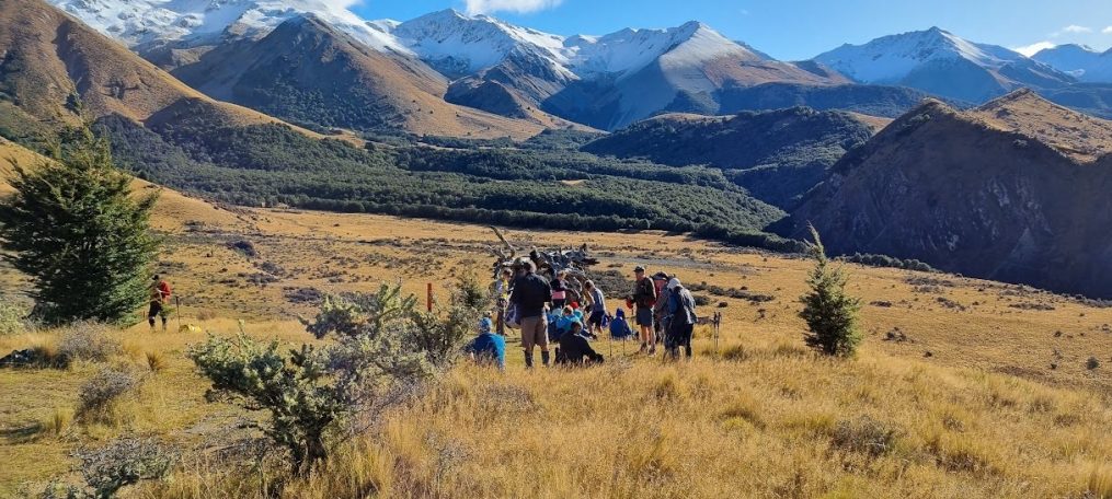
PMH – Bowenvale 13 March 2024

Leader Mentor Understudy Tail Ender
Standards Graham W Jan Br Brent Frank
Alternates Ray Daphne Ali Eric

Distance:12.5km                               Elevation gain: 600m                        Total time: 4hrs 15mins

An eager group of trampers alighted from the bus at PMH where they were joined by a smaller group including visitor Nicky C waiting in the carpark.

At 9.15am the groups set off,  Alternates following the Standards as they steadily made their way up the short track to Lady Polson Lane. Surrounded by a variety of fruit and nut trees,  we passed by the Cracroft Caverns. The Caverns had been secretly constructed during World War 2 when, in the event of an attack, they were to be used as South Island operational headquarters. Following the war the Caverns remained largely forgotten until their chance discovery in 1987. More recently they provided a stable environment for the University of Canterbury’s ring laser laboratory measuring variations in the earth’s rotation.  The Caverns have been closed to the public since the Canterbury earthquakes.

On Lady Polson Lane one sharp-eyed member of the group observed a gorgeous specimen of purple autumn crocus. (The deceased hedgehog in the adjoining gutter didn’t receive such positive attention). From Hackthorne Road, we made our way up to Cracroft Reserve and the Sign of the Takahē continuing uphill to Victoria Park, where we stopped at the top for morning tea.

Back on the track we paused to observe the awful devastation caused by the recent bush fires on the Port Hills. On Latter’s Spur Track we climbed through native bush to a rocky spur with spectacular views across Lyttelton Harbour. From there we continued along to Mitchell’s Track (which is part of the Crater Rim Walkway) to Scott’s Reserve where our leader Ray found a perfect lunch spot providing a great view of the valley and shelter from the wind.

After a convivial lunch, the eight intrepid Alternates descended the Bowenvale Valley Track. En route we were entertained by the sight of two mobs of sheep being mustered by clever, fearless and obedient dogs under the  command of their respective owners.

Forty five minutes later the Alternates group reached the end of their descent at Bowenvale Avenue where the Standards were waiting by the bus. To complete a very enjoyable day, we adjourned to the Brickworks for refreshments before heading back to the bus.

Thanks to Frank for providing us with chocolates celebrating his birthday and to Marie-Therese for hers in celebration of the arrival of her latest grand daughter. Thank you to Stuart our bus driver for the day.

Text by Margaret C

Boundary Hill – 6 March 2024

Leader Mentor Understudy Tail Ender
Standards Chris S Alan H Jen Marg E
Alternates Ray Gavin M Ali Moira

Stats: Standards & Alternates

Distance: 11 & 7.6km                                    Elevation gain: 418m                Time: 4hrs 48mins & 4 hrs

After picking up the group at Yaldhurst, 46 trampers set off in the bus with driver Stuart for the drop off point along the Lyndon Coleridge Road. Although sunny when we arrived, the wind was a bit chilly so extra layers were put on before the 24 standards and 22 alternates set off along a four-wheel drive farm track.

Both groups initially followed the same track, until shortly after scrambling over a washout in a gully the standards branched off to the right taking a longer route to Boundary Hill, while the alternates carried on further up the track to their morning tea stop. By this stage the cool wind had dropped away and extra layers were being discarded.

The farm track gave way to a boggy landscape scattered with prickly matagouri and Spaniard grass. Matagouri is a New Zealand native and has complete protection on public conservation land and some protection on private land. The spines of the plant were used by Māori for tattooing when there were no better tools available.

With no real track it was slow going, especially for those at the front forging their way through the matagouri and tussock and on uneven ground warning those following with occasional shouts of “Hole”! Back on firmer ground at the top of the ridge, the standards could be seen across the gully in the distance.

Reaching the base of Boundary Hill, some elected to have lunch at the bottom, while 13 of the group trekked up the narrow path to the top. The view from the top of the hill taking in Lake Coleridge and the Rakaia River with a smattering of snow on the distant mountains was well worth the climb, and there was still plenty of seating in the sun for the standards when they arrived a short time later.

After lunch, with some of the group thinking how fortunate they were to be avoiding the steep drop-off on the route the standards were taking, the alternates made a unanimous decision to follow the fence line down, rather than retrace their steps on the narrow path, which would have been slippery due to loose stones.

Arriving at the bottom with shredded legs, except for those with long pants on, the two groups reformed for the tramp back to the bus, taking the route the standards had taken on the way in. Earlier discussions about orange markers and pre-cut matagouri meant the return trip was easier, and the fault line, marked by a stony ridge lacking vegetation, was reached without incident. There was time to take some photos before the group moved on.

After one last climb and descent, it was encouraging to see the bus in the distance. The route back was reasonably straightforward, apart from having to cross a small stream, where some got to show off their long-jump skills. Helping hands on the other side meant everyone got across safely.

With a quick change of footwear, it was back on the bus for the drive further up the road to pick up the waiting standards.
Although there were a couple of sticking points, it was an enjoyable tramp with ‘a bit of everything’.

Text by Sally

Pony Point to Barnett Park – 28 February 2024

Leader Mentor Understudy Tail Ender
Standards Chris S Wendy A Chris H Brent
Alternates Ali Jan B Michele S Stuart C

Distance: 13km                                                         Elevation gain: 580m                                  Time: 4hrs 30 mins

Today’s walk was a day with mist and wind making for a cooler start as we set out, 44 walkers in total. Four members had been collected at Barnett Park, our scheduled end destination. Our driver Viktor deposited 27 Standards at Pony Point and the further 17 Alternates a little closer towards Lyttelton, whereupon Shanks’ pony became the order of the day. Throughout the day there was a good deal of rearranging attire to suit the conditions.

Alternates made way for Standards as they, too, arrived at Three Piece Suite Reserve for the morning tea stop. Alternates closely followed by Standards, all then carefully followed the mapped route to the start of the track proper. Frequent cries of “Car” sounded out as we headed upward through the narrow Lyttelton streets.

While climbing the many steep steps of Major Hornbrook Track, a descending quartet enquired who we might be. The quick, straight-faced response was that we were passengers from the cruise ship Queen Victoria currently in port, dominating the Lyttelton terminal. There was surprised admiration from the walkers until one more reliable member admitted that we were actually from BTC.

Still further up the hill one member observed that it was a little easier walking along a graded uphill track than ascending steps. That’s because there is a cadence to the walking, was a considered viewpoint. A cautionary sign warned us to move quickly through the potential rock fall area. Picking up the pace was easier said than done, more of a keeping on going and getting to the top, good rhythm or otherwise. Both groups eventually achieved the Summit Road whereupon walkers draped themselves beside flax bushes, leeside of wind and mist, and enjoyed their lunch.

Standards soon disappeared from view into the mist, with speculation by Alternates as to where they might be. Mystifyingly the Standards loomed out of the mist behind the Alternates, having been on a loop track to the gun emplacements. Though with lack of visibility they, too, could have told the Alternates another tall tale. It was pretty much downhill at that point – via the Eastenders Track to Barnett Park and sunshine.

Everyone was back at the waiting bus around 1430 hrs. With the early finish we were then able to conclude the day with refreshments at The Valley Inn Tavern before the drive back across the city.

Listed diary volunteer Jen who had been unable to tramp due to a bee sting incident suggested the inclusion of a random pony fact. So for what it’s worth, and because the question was once posed… How high can a Shetland Pony jump? According to Google these ponies can jump about a meter.

In summary, another good day of exercise, encouragement, good leadership, laughter and conversation, albeit with little view from the vicinity of Summit Road.

Text by Marie-Therese


Hogs Back Track – 21 February 2024

Leader Mentor Understudy Tail Ender
Standards Dave R Sally Brent Glenys
Alternates Les G Ali Eric S Les H & Gary

Distance: 15km                                     Elevation gain: 500m                     Time walking: 4hrs approx

Another early notification of tramping route change away from the Port Hills saw 42 walkers being transported westward by our driver James, to the Craigieburn Forest Park. This saw the writer abandoning a diligently sourced screed of frivolous pony data. Said writer also announced a new filly in her family, and celebrated the safe delivery of granddaughter Melanie with a sharing of goody bag.

Hogs Back 1032 m. This small peak is reminiscent of the shape of a lenticular cloud, otherwise known as a “hogs-back” for its distinctive form, which often indicates a powerful system moving in. Combined with strengthening winds, this often means a storm will approach in the next 6-24 hours. The cloud type is familiar to Cantabrians with the Foehn effect, the nor’westerly airstream that flows from the Tasman Sea over the Southern Alps. Cirrus or “mare’s tales” are another first sign of an approaching front.

For anyone who has spare time, there is a Cloud Appreciation Society   https://cloudappreciationsociety.org though from listening to the varied activities of our members, there seems little idle time on the horizon. Today there was an absence of cloud in the cerulean blue sky, a stunning day, though the early approach of autumn was noted.

After setting out from Castle Hill Village the 14 Alternates didn’t quite make it to Picnic Rock, a 15th member of the group having been escorted back to the bus in an early retreat, after becoming unwell. With the two groups there was competition for the limited shade at The Lightening Tree as we all enjoyed our morning tea stop. Both groups navigated the switchbacks through undulating beech forest, over open tussock, across bridges and through streams. Bird song elevated the setting along the way.

The 27 Standards continued on to the top of Hogs Back, lunched at the top, but soon returned back down to the shade as “it was very hot”. However this was not before viewing in the distance a lone paraglider, plus a mirage, indicative of the still conditions and hot day. Meantime the Alternates quietly lunching in the shade were surprised by the sound of people returning along the track. Had the Standards raced down and snuck up on them? Not at all, it was a group from the Over Forties TC, also enjoying their walk, away from the city.

Both Alternates and Standards chose to walk back along the longer but less steep track, the vote of one dissenter being overruled in favour of the majority. The lone walker conceded and plodded cheerfully on. Alternates arrived back at the bus about 10 minutes ahead of the Standards, approx. 12.5 km for Alternates, 15.3 km for Standards.

There’s much to be grateful for on such days – good company, conversation, leadership roles well undertaken, along with all the benefits of exercising in the great outdoors.

Text by Marie-Therese

PMH – Governor’s Bay 14 February 2024

Leader Mentor Understudy Tail Ender
Standards Dave R Alan H Cath L Veronica
Alternates Graham W Lynne R Jan Br Tessa

We received an early warning that our scheduled Glenafric tramp was cancelled due to the danger of fire and we soon learned it was to be replaced by this new tramp. The Standards disembarked at PMH and did a wander uphill (mostly) before looping around and entering the Canterbury Adventure Park (CAP). Meanwhile the Alternates were dropped at the start of the CAP track that leads through the park and eventually to Worsleys Road. The temperature forecast was for 29 degrees so all 35 trampers were keen to get cracking before the sun reached its zenith.

The Standards, looking for a convenience stop at morning tea, found that most of the many toilets at the Park’s HQ were locked, requiring some to explore other options, including the café’s loos one of which required passing the delicious food and wine on display. Resisting temptation, we reconvened and were soon setting off up the track. At this stage, we were all feeling a lot of love (it was February 14, remember) for those who had designed the path with the many switchbacks enabling us to master the increase in altitude without much difficulty. Unfortunately, as the zigzags disappeared and the steeper grunts presented themselves, falling out of love came a lot easier than the steady uphill climb which was now our reality. A big thank you to our fellow trampers who patiently assisted those for whom the going was getting tough!

The Standards had lunch at the top of the track beneath a large shady tree with a pleasant breeze to cool us as well. At the end of the day, when the two groups met up at our destination, some were astonished to learn that the Alternates had pressed on to the Sign of the Kiwi for lunch. Here, a former member met up with her husband. How lovely we thought – a romantic assignation on this special day! But no, there had been no expectation of actually seeing each other, and Margaret and Eric ate their lunch at separate tables. The Alternates then walked around Coronation Hill before reaching the start of the Governors Bay Downhill Track.

Having been assured at lunch that “It is all downhill from here” some of us did wonder later if this remark had been a rather bleak comment about the person’s own future, or perhaps directed at those lying semi-comatose around him, rather than an accurate description of the topography. However, reaching the same track as the Alternates ahead of us, we found that it was indeed mostly a downhill walk with some very hot open sections interspersed with beautiful cool bush and cheering birdsong to lighten the mood.

Stopping for the obligatory photograph at the Reuter Park Memorial to Horst and Christa, there was a lot of interest in the pair. In the course of googling – the local Reuters gifted 23 ha of land above Governors Bay to the City Council in 1994 – I can tell you it’s best to avoid Reutter Park in Michigan USA where there have been three shootings in the last year!

And now for those who deal in stats: Standards walked approx. 14.1 km (sounds very specific for an approximation); elevation gain 745 metres (surely that should be a 9 at the start of that number); and took 4.75 hours. Alternates covered 12km approx.; climbed 540 metres and were out and about for 4.16 hours (4hrs 10 mins for those who can’t find the calculator). And Gary was able to tell us that at the turnaround at Worsleys Road we were 1501ft (457.5m) above sea level. In a nutshell all that is really important is that the Alternates beat the Standards to the bar at Ōtoromiro Hotel by 35 minutes! Well done! And thank you for leaving plenty of cool refreshments for the second team home.

Starting the homeward journey, it was evident that not too many had been able to postpone gratification, i.e. save Linley’s birthday chocolates until later. Whenever they were consumed, we enjoyed the treat. Thank you, Linley. As we bused down Dyers Pass Road (thank you to our driver Viktor for navigating the road and hill-parking) it was very sobering and worrying for us all to find that having our expected tramp cancelled due to the risk of fire, we were now looking at what appeared to be a large fire in much the same area as we had just been walking. We are thinking of all those families who have had to be evacuated in the face of this rapidly moving threat and hope that it will be contained and extinguished before reaching the disastrous proportions of the Port Hills fire seven years ago.

Finally, a huge thank you to the Programme Committee for this new walk, and to the leaders, mentors and tailenders of both groups who kept us on the straight and narrow.

Text by Jan Bw


Rakaia Gorge 17 January 24

Leader Mentor Understudy Tail Ender
Standards Peter M Graham W Brent Kay and Kate
Alternates Eric Norma Gary G Min

Distance 10.3km; duration 4hrs 20min; vertical ascent 414m

For our first walk of the year we had 45 trampers including one visitor, Judy S. Our driver was Viktor. We welcomed the return of Selwyn and Pip following surgeries and injury. On a day like Wednesday was, this is a perfect first walk for the Club. Gentle ups and downs, sun and dappled shade and views of the  glacial turquoise of Canterbury’s biggest braided river, the Rakaia. The river was formerly known as Ō Rakaia meaning the place where people were ranged in rank, referring to the practice of strong men standing in line to break the force of the water when crossing. For Ngai Tūāhuriri of Kaiapoi it was a mahinga kai/food gathering place. Apparently at the river’s mouth up to 1,000 earth oven sites used for cooking moa have been recorded.

Mention has to be made of the wrought iron bridge – one of the country’s oldest. Constructed between 1880 and 1882 by Oamaru’s W H Barnes, the bridge features a timber deck and handrail atop its wrought iron plate girder and truss. The truss is unconventional in having no bottom chord and its ties fan out from the gorge’s edge carrying the load forces to the bridge’s anchors. It’s a handsome bridge.

It was a walk filled with catching up with summer goings-on, news of growing families and adventures had and planned, house moves and bathroom renovations. We do look forward to finding out who got first use of Brent’s new bidet! Punctuated by bellbird song and walking amid knee-high grass with Tussock Butterflies floating beside us talk turned to frequency of cat grooming, finding indestructible toys for dachshunds – and turtles.

Alternates and Standards all lunched beside the river and on our return walk some of us followed a side track to look at the old coal mine site. When all were back on the main track  our two groups had merged and we walked out together though a little crawling was required by some with a fallen tree over the track. One of our number was all over the fallen tree issue and once on the bus had reported it to Snap Send Solve by 1526 hrs. By 1600 hrs she had received five replies ultimately advising that the issue of the fallen tree is currently with ECan. Hopefully ECan will deal with the tree promptly. The track had been busy with mid-week walkers – domestic and international.

In response to our tramp leader’s enquiry the Hororata Café advised that they were short-staffed and closing at three so Viktor drove us home without stopping. A thoroughly enjoyable first walk for 2024.         Text by Jen C

Sources

Te Maire Tau, Anake Goodall, David Palmer & Rakiihia Tau. Te Whakatau Kaupapa: Ngāi Tahu Resource Management Strategy for the Canterbury Region, Aoraki Press, 1990

Aidan J. Challis, Ka Pakihi Whakatekateka O Waitaha: The Archaeology of Canterbury in Māori Times, Department of Conservation, December 1995

G M Jones; ‘Rakaia Gorge Bridge – The truss that isn’t‘ (PDF 1MB), Proceedings of the 1st Australasian Engineering Heritage Conference, 1994.

Otoromiro_Christmas Lunch 13 December 2023

Sadly the weather on the hills was forecast wet, making hill walking slippery underfoot so we forewent our planned pre-lunch walk.

As in the two previous years we had booked our end of year/Christmas lunch at Ōtoromiro Hotel. Sixty people lunched including several long-standing members of the Club who have recently resigned, and our treasured driver Viktor. Thank you Viktor for the  festive manuka honey and ginger lollies.

Happily the sun made an appearance after we’d finished lunch so we took the opportunity to walk out to the end of the jetty. By 2.45 pm we were on our way home to the city.

Text by Jen C

Mt Grey 6 December 2023

Leader Mentor Understudy Tail Ender
Standards Bev F Graham Brent Shirls
Alternates Ray B Gavin Ali Min

Distance 11.5km, vertical ascent 665m, time 4hrs

The 22 Alternates did not need the digitalis in the lovely foxgloves lining the path to get their heart beats up as leader Ray led us up through the slash and on to the trail headed up Mt Grey. For those of us who were under the belief that this was an easy trail (including Jacqui D, completing her third visitor tramp), we were in for an awakening. We quickly discarded jumpers and other extra clothing.

Ray allowed a few breaks before our stop for morning tea, albeit tea was before the lookout which has been the goal in the past. Two morning tea breaks is not necessarily a bad thing, and we were challenged by a non-BTC tramper at the lookout to meet him at the top.

And meet him we did, arriving at the top by noon for spectacular views across Ashley Forest. We were followed shortly by our driver Viktor (who had stopped the bus on the shingle road to rescue an extra set of keys to the bus from the wheel well left by an earlier driver). About mid lunch break, we saw the 19 Standards lead by Bev winding their way up the hills. Not wanting to be passed by them on the way down (and because we had been there 30 minutes), we quickly concluded lunch and then formed a “military sword salute” with our hiking poles to recognize the Standards’ sweaty faces as they arrived. Well, most of them were honoured as we could only wait so long.

Per a source in the Standards, nothing happened worth reporting on their tramp.

The only reminder for the Alternates was that the trail was as steep on the way down as it was on the way up. Fortunately, only a couple of tumbles occurred in the slippery mud spots, and we all arrived at the bus in good shape.  The Standards arrived within 30 minutes, and we were off to Bishopdale after a short stop requested by Judy to allow two hitchhiking bees to escape the bus and continue their pollination activities, arriving back in Bishopdale by 4pm.

Text by Michele S

Mt Barossa and Lake Clearwater 29 November 2023

Leader Mentor Understudy Tail Ender
Standards Brent Janice Graham Frank W
Alternates Ali Alan H Michelle Sally

Standards:  distance 7.3km; duration 4hrs 30min (approx); vertical ascent 824m

Alternates: distance 10km; duration 3 hrs

Alan was our driver picking us up at Bishopdale at 8am. There were 43 of us on the bus including visitor Jacqui and guest John. The Alternate group was walking around Lake Clearwater for the first time, rather than up the Stour River as in 2022.

The 13 Standards were laughing nervously at the start as we were wondering if you lot were being much smarter than us! But I don’t think any of us regretted doing the Barossa option. Yes. It was just up up up all the way to the top, and we were in thick fog almost all the way from morning tea. And so cold after lunch we had to dig out all our almost-forgotten items from the depths of packs, like zip-off pants bottoms and neck warmers.

But there were plenty of highlights too: the incredible limestone tors at the top, singing a silly song together on top of one of those massive rocks, the gorgeous shards of quartz rock in pretty pastels lying around like discarded treasure,  the delightful tiny sub-alpine flowers, witnessing from afar the hundred head of black cattle complaining loudly as they held up the traffic and leader Brent’s wacky idea to march (supposedly in unison) back to the bus!

Text by Shirls

After dropping the Standards at the bottom of a mist-covered ridge the Alternates sat on the bus for long enough for there to be some ‘Are we there yet?’ moments. We reached Lake Camp/Ōtuatari and some of us mistaking it for Lake Clearwater/Te Puna a Taka were surprised. It is a very small lake. Would we do several circumnavigations? Others knew it well, from earlier water-skiing days. It is the only lake in the area where powerboating is allowed.

There’s a cluster of fishing baches on the shores of Lake Clearwater. Brown trout apparently. And it’s a pretty walk around it. Sadly the lake’s future may not be so pretty. Without urgent action its imminent death has been heralded (David Williams, Newsroom, 18/02/2023). There are indications that due to land use, cow numbers and intensive farming, the lake could be flipping – transitioning from a clear, macrophyte-dominated state to a turbid, algae-dominated state. However over the past two years this transition has been slowed by ECAN and local landowners working together to encourage relocation of winter grazing to lower-risk areas, fencing waterways to restrict cows’ access and farming sheep.

On a happier note, the lake is also home to bitterns, wrybills and after receiving votes from a global fanbase Forest and Bird’s 2023 Bird of the Century the Pūteketeke or Australasian Crested Grebe.  Thanks for its newly acquired celebrity status in large part go to John Oliver. Some of us were out to spot a nesting pair. We didn’t. The closest we got was a sign describing them.

Pūteketeke signage

The wait in the bus for the Standards on our return was short and filled with speculation about who was who as we watched their descent. What happens on the bus stays on the bus. Despite not seeing the now famous bird, it was a fun day out and we were home shortly after 5pm.

Text by Jen C

Annavale – Sugarloaf – Benmore Hut – 13 Mile Bush 22 November 2023

Leader Mentor Understudy Tail Ender
Standards Dave  R Chris Brent Janice
Alternates Ray Norma Ali Moira

Distance 14.4km; duration 5hrs 30min (approx); vertical ascent 577m

Now before anyone gets the idea that this was an easy little toddle on the Port Hills, you should know the Sugarloaf in question is not the Christchurch one with a tower on it. It’s not the one near Motueka, nor the Otago one either. Sugarloaf just happens to be a popular name for many nice rounded hills. No, this tramp was a bit tougher than the Port Hills one, and far more interesting too.

Our two groups totalling 45 trampers including visitor Mijung, set off from Benmore Station carpark just before 10am. Let’s be honest, that farm track towards the hills seems to go on forever. At least the stream crossings were a bit more fun – especially when one of the Standards bounced over the surface like a skimming stone, before the inevitable ‘plop’ of going down (I heard an Alternate had a bit of a splash too).

It was getting warmish as we made our grunting-grumbling way up the steep Annavale track, which made stopping for a late morning tea with glorious 360 degree views all the more appreciated. When we got to the signposted junction it was good to know we weren’t taking the track up Sugarloaf, but rather the one on the right towards our goal, Benmore Hut. A shorter distance, and through rather nice bush, but with its own challenges. Especially the really steep downhill bits just before lunch – these were best negotiated with a low centre of gravity, whilst hanging onto handy little trees growing close to the track.

The best thing about the Benmore Hut is that you can’t miss it when you’re getting close. Whoever decided this rustic, easy to find hut should be painted in almost-fluoro orange must have had a good sense of humour. It is certainly located in a lovely spot, with plenty of shade perfect for cooling down as we ate our hard-earned lunch (no pesky wasps or Over 40s trampers this time!).

Downhill after lunch – sounds ideal if not idyllic. And the track through the beech forest offered lovely dappled light, a little birdsong … and lots of mud. It was interesting to see the many predator traps, including the new really high-tech ones. Even better was seeing that there was a very dead black possum caught in one of the older traps.

How many heads got bumped on the low hanging branches?  Only two that I observed, but there were most likely others (not me this week, tee hee!). Then there were all the tree trunks lying across the track which had to be climbed over (going under was fun too). And how many people slipped over when we constantly had to cross over the stream? – a few.

As for the return journey on that terribly long farm track we had traversed in the morning? Well, it seemed twice as long on the way back to the bus. It was 3.30pm when the weary Standards made it to our flash bus waiting back at the farm carpark, along with our driver James. By then the 17 Alternates had been waiting for an hour and a half. They too had had their fair share of steep uphill farm track walking, steep downhill farm track walking, rough tracks through beech forest, as well as lots of stream crossings (I did hear that they had also enjoyed two morning tea breaks, but that’s just a rumour).

After being undertaken three times by our club now, this tramp has likely earned its place on our yearly calendar, with its varied route and just enough challenges to stop us feeling we’ve easily mastered it.

Text by Shirls