Rakaia Gorge Walkway 12 January 2022

Leader Mentor Understudy Tail Ender
Standards Jan B  Wendy A  Glenys D  Kay L
Alternates Margaret S  Ray B  Eric S  Nick A

 Standards Stats: 11.3km – Duration: 3hr 50min – Elevation Gain: 412m
Alternative Stats: 10.6km Duration: 4hr 33min – Elevation Gain: 332m

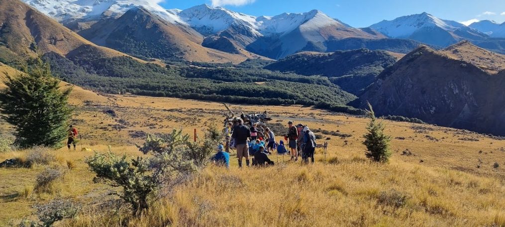
A group of 40 trampers set off with one of our regular drivers Alan. Our numbers included four visitors, regulars Tony G and Steve G and two new visitors Jaki H and Daphne H. 

Our President indicated how good it was that the day was not going to be too hot. She was starting to rethink that as we got closer and the drizzle got thicker and the fog came down but everyone was relieved as it cleared as we headed down the hill and parked at the start. 

The Rakaia Gorge Walkway begins next to the unique wrought-iron Rakaia Gorge Bridge – the only design of its type in the world!  The 55-metre single-span bridge has trusses that fan out underneath carrying the load to the gorge edges. It was built from 1880-82 for a growing inland population and farming industry. It was built strong enough to take rail, but this never eventuated. The bridge is a Heritage NZ Category One Historic Place. The second bridge that completes the gorge crossing is concrete and newer.

​For Maori, crossing the Rakaia River was a major event. Records tell of Maori crossing in rows holding onto a pole. When European people started settling in Canterbury, an Accommodation House was built by the Rakaia Gorge by John Bryan in 1851. It included a smithy, post office, bar and cattle yards. It burnt down in 1878 and was not replaced, but while Bryan was there he ferried travellers, stock and goods across the river in a flat-bottomed punt pulled by a rope from the other side of the river. The Rakaia Gorge Walkway includes a section of the track that led to the Accommodation House, which was on a terrace on the north side of the river. 

As we exited the bus to start, the Over 40’s Tramping Group set off ahead of us.  We started across the road and headed up the gorge track admiring the stunning blue of the Rakaia River and the views of the bridge as we went. 

We hadn’t gone far when we stopped as one of the Standards was stung by a bee!  Setting off again the track continued to wind up and down through the bush and past farmland until we arrived at a clearing and viewpoint for our morning tea break.  The Over 40’s took one look at us as we arrived seemed to decide it was time they finished their break and headed off again. After morning tea it didn’t take too long before the standards could hear the Over 40’s as they stopped at the old mine site.  We were pleased they continued along the track as we headed up on the track to the high point. 

After reaching our maximum elevation of 433m and admiring the views of the gorge and surrounding farmland and hills we headed back down to the river for lunch, passing the Over 40’s (again) as they headed up to have their lunch at the top.  The Alternates arrived at the river not long after the Standards and we enjoyed a leisurely lunch and were entertained by one of the jet boats showing off in front of us.

The Standards then headed off, followed soon after by the Alternates and were on the bus in plenty of time to stop for refreshments at the Hororata Café & Bar.  As always, the first tramp of the year was a good one with everyone enjoying the company and the walk.
Tramping Programme 12 January 2022 – 30 March 2022

Note: The cost of all tramps is $20

12 January         8.30am               Rakaia Gorge Walkway

Standard route: An easy walk from Evans Family Reserve to the boat harbour and return. Some moderate climbs and descents with lovely river and gorge views.

Alternative route: As above, but via the LoopTrack

Stats: distance 10.3km, vertical ascent 414m, time 3hrs 30mins

Alternative Pickup: Yaldhurst

 19 January         8.30am               Coalpit Spur

This is a new tramp in Craigieburn Forest Park.

Standard Route: up Mistletoe track to the ridge then down Craigieburn Road and drop down Coalpit Spur.

Alternative Route: around Sidle 73 track before descending the Coalpit Spur track.

Stats: yet to be recorded

Alternative Pickup: Yaldhurst

26 January         8.30am               Okuti Valley, French Peak

This is a new tramp out from Little River. A farm walk with steady inclines to a saddle where the Alternates can stop for lunch while the Standards head up French Peak.

Stats: distance 14.8km, ascent 720m, time 4hrs 30mins

Alternative Pickup: Halswell

2 February         8.30am               Glenafric

Walking over undulating farmland to the coastal cliff for lunch with great sea views.

Standard Route: Returning via the beach. Alternative Route: Returning via farmland.

Stats: distance 14.3km (alternates 13km), vertical ascent 640m, time 5hrs

Alternative Pickup: Woodend

 9 February         8.30am               Gebbies Pass – Kaituna Valley

Alternative Route: A gentle climb through pine forest and farmland to the Packhorse Hut, descending to Kaituna Valley after lunch.

Standard Route: As above, but continue along Mt Bradley Track for lunch before descending to Kaituna Valley.

Stats: distance 13km, ascent 560m, time 4hrs 40mins

Alternative Pickup: Halswell

16 February       8.30am               Mt Oxford – Ryde Falls

Standard route: Mt Oxford: A challenging climb of Mt Oxford with magnificent 360-degree views to enjoy at lunch time.

Alternative route: Ryde Falls. Beautiful steady, mostly bush walk to the falls. Some stiff climbs and descents.

Stats: distance 15km, ascent 960m (alternates 218m), time 5hrs

Alternative Pickup: Tram Rd cnr Greigs Rd

23 February       8.30am               Craigieburn Forest Park – Ski Lodge – Hwy 73

Standard route: Steady ascent to Lyndon Saddle to join Craigieburn Valley Track.

Continue on track to ski field base, and return via ski field road to SH 73.

Alternative route: Short walk along Craigieburn Ski Field Road to join undulating Craigieburn Valley Track. Continue along track to ski field base, returning via ski field road.

Stats: distance 14km, vertical ascent 612m, time 4hrs

Alternative Pickup: Yaldhurst

 2 March              8.30am               Kate Valley – Tiromoana Bush Walkway

Standard Route: An undulating descent through Tiromoana wetlands and farmland. Detour from the wetlands track to climb Ella Peak before continuing to the beautiful Pegasus Bay beach for lunch. Steady ascent along a shingle road to the bus.

Alternative route: As above, except for the climb to Ella Peak.

Stats: distance 12.8km (alternates 11km), vertical ascent 424m, time 4hrs 25min

Alternative Pickup: Woodend

9 March             8.30am                Peak Hill Lake Coleridge

Standard Route: Follow track from the bottom of Peak Hill to the summit, a climb of 700 metres. The leader may choose to return by the same or the alternative route.

Alternative Route: A shorter climb from the bottom to the first knob for lunch and return.

Stats: distance 9.5km, ascent 650m, time 4hrs 20mins

Alternative Pickup: Yaldhurst

16 March           8.30am               Sugarloaf 13 Mile Hut

Standard Route: The track follows 13 Mile Bush Stream through the beech forest with several stream crossings and a steady climb to the hut. The track is typical of many back-country hunters’ trails, covering rough ground in places.

Alternative Route: As for Standards for as long as terrain and stamina allow. There is an open gully that would be a suitable lunch spot.

Stats: yet to be recorded

Alternative Pickup: Yaldhurst

 23 March            8:30am               Mt Alford

Standard Route: Steady climb through Alford Reserve beech forest, tussock country and then sub-alpine scrub to top of Mt Alford. Great views. Return via same route.

Alternative Route: Same as above climbing as high as able, followed by side trip through Alford Forest Scenic Reserve

Stats: distance 9km, vertical ascent 730m, time 4hrs 45mins

Alternative Pickup: Yaldhurst

30 March            8.30am               Sign of the Bellbird to Evans Pass

An open, grassy ridge climb with some rock-hopping to start and then ranging from easy to steeper climbing and descent sections.

Standard route: Crater Rim walkway from the Sign of the Bellbird to Evans Pass.

Alternative route: Crater Rim walkway from the Sign of the Kiwi to Evans Pass.

Stats: distance 17km, vertical ascent 410m, time 5hrs

Alternative Pickup: N/A


BTC By-Laws

Club by-laws

Introduced on 1 March 1999 and amended 10 August 2010 and November 2021 by the Committee, in accordance with the Constitution.

These by-laws shall apply to all participants on Bishopdale Tramping Club tramps.

1. ORGANISATION

  1. The Committee shall devise a programme of tramps and distribute a copy to each member. The price of each tramp shall be shown on this programme.
  2. When members take cars to supplement the bus, they shall be remunerated according to a formula decided by the Committee.
  3. When members incur expenses organising approved club activities, e.g., Social, Tramp reconnaissance etc. they should be recompensed.

2. LEADERS AND TAILENDERS

  1. On a tramp, all groups shall have a designated leader and tailender. If the Leader and/or Mentor have any concerns relating to the tramp they should consult the President and/or Planning Committee Lead (or substitutes) prior to commencing the tramp.
  2. The leader shall be responsible for:
    1. The route to be followed
    2. The time and place of any refreshment stops, including lunch
    3. Setting a suitable pace
    4. Consulting with the President, or substitute, if a serious problem develops
    5. The leader can advise against a member’s participation in a tramp or part of a tramp
    6. Nominate a person to be responsible for leaving gates as found
  3. The tailender shall be responsible for:
    1. Knowing how many are in the group
    2. Notifying the leader of any problems within the group
    3. Looking after any trampers needing help
    4. A Club Emergency Kit and Personal Locator Beacon

3. EQUIPMENT

  1. Trampers should come prepared for sudden weather changes at all times.
  2. All trampers on Club tramps shall have the following equipment:
    1. Strong comfortable boots or shoes
    2. Day pack
    3. Wind and rain proof clothing
    4. Warm jersey or shirt, wool or polypropylene
    5. Woollen hat and gloves
    6. Basic first aid kit (the Club’s Emergency Kits are not intended to be used for minor problems)
    7. Whistle
    8. Food and water (1½ litres of fluid suggested)
    9. Light, clean footwear to wear on the bus after the tramp
    10. Dry clothing to change into if necessary (may be left with footwear on the bus)
  3. Trampers are advised to have the following:
    1. Tramping boots
    2. Sun hat and sunscreen
    3. Spare laces
    4. Insect repellent and anti-histamine
    5. Toilet paper
    6. Waterproof over-trousers

4. SAFETY

  1. Members shall avoid placing fellow trampers in the position of having to supply equipment, or having their safety compromised.
  2. The requests of the leader shall be complied with.
  3. Three blasts on a whistle shall indicate a problem, and two blasts shall indicate receipt of that message.
  4. A name tag shall be attached to the pack, showing the member’s name and on the back a contact number.
  5. Members must complete the Emergency Information Sheet and carry it inside a plastic bag in their first aid kit.
  6. No tramper shall:
    1. Move ahead of the leader, or on a different route, other than as agreed by the leader
    2. Go behind the tailender, other than as agreed by the tailender
    3. Leave the group unaccompanied, other than as agreed by the leader or tailender
  7. All trampers shall watch for those immediately behind them, to ensure they are aware of the track to be followed, especially at junctions.
  8. If a member must leave the track for toilet reasons, they shall leave their pack on the track.

5. BOOKING A TRAMP

  1. Bookings for members, including those going by car, should be via the Hello Club booking system. Visitors can book via bookings@bishopdaletrampers.org.nz.
  2. Members have priority over visitors until 5pm on the Monday before the tramp.
  3. Trampers who cancel the tramp before 8am on the Tuesday prior to the tramp will receive a full refund.
  4. Trampers who cancel the tramp after 8am on the Tuesday prior to the tramp will forfeit the cost of the tramp.

6. LAND USAGE

  1. Permission shall be obtained from landowners before any Club members go onto private land (Normally this will be done in advance, by a designated committee member).
  2. Because we are reliant on the goodwill of landowners, and in the interests of the environment, trampers are expected to keep to the track or to follow the leader; to cross fences or gates when advised by the leader; not to disturb stock unnecessarily; not to litter.

Poet’s Corner

A Poem:

Flowers Track for starters from Sumner we did climb,
The day was curtain clouded with the weather promised fine,
Captain Taylor in his schooner made an obvious mistake,
As we trod the sandy beachfront leaving footprints in our wake.

Out to the remnants of a war that never came
With gun emplacements silent, wooden barracks still the same.
Richard told a story of the reason for the site,
To protect the eastern Aussie shore from Japan’s  naval might.

Enough of this nonsense, regards Terry.

1st July 12.00pm Birthday Party & AGM

page1image9725904

Bishopdale Tramping Club invites you and your partner to our 35th Birthday party!

This event will be held on Wednesday 1st July at the Quality Hotel Elms, 465 Papanui Road.

  • Buffet Lunch & AGM 12 noon.

  • Enjoy a presentation about The Old Ghost Trail.

  • Booking & Payment ($40) by 25th June.

  • Payment to BTC account no. 03 1702 0089032 00 with your name as reference.

  • Payment can be in cash to Norma.

  • No bookings or payments on the day.

  • RSVP by 25th June please.

We look forward to seeing you there!


page1image41432960 page1image41432576 page1image41430656

Wilding Pine Eradication Day Wednesday 9 October 2019

Hi People

Thank you to the trampers who have already volunteered for our free bus, wilding pines eradication day this year.  There are still a number of spaces to fill so let Peter know if you are able to help. The designated area is alongside SH 73, on the right looking back towards Parapet Rock.  Wildings are dotted throughout the area extending from the roadside, over the fence and sloping up to the higher scrubby ridge.  Most are small to hip-high but also look out for the really tiny ones.  

Use Safe practices at all times please – especially when crossing and working alongside SH 73.

Each person will need the usual gear for a day tramp plus:

  • gardening gloves
  • optional knee pads/kneeler/hi vis vest
  • extra snack food/hydration
  • spare socks for after (the ground is boggy in places)
  • if you can bring your own tools such as:  short loppers, sharp knife, pruning saw, small axe or secateurs, that would be appreciated and help augment the supplied gear. [be safe with using these sharp tools please]

Format for the day will be as follows:

  • arrive on site.  Bus will park and packs can be left.
  • take anything you might need for the day (jacket, drink bottle, energy snacks, inhaler, tools, gloves etc) with you. [maybe in waist pack]
  • decide on a “group” to join. (flat-roadside [Ian]/ middle [Bruce]/ sloping scrubline [Alan]).  The idea is for us to have an even spread of people extended over the site and work in a line where possible. [i.e. approx. 10 per group].
  • get tools (saw/loppers) and a safety vest
  • gather for short demo 
  • morning tea at the bus
  • proceed to chosen areas and start.
  • Lunch back at bus 12.30
  • depending on progress, the bus can move to the next safe parking area as we proceed.  
  • Finish time approx. 2 – 3pm.
  • Refreshment stop at Springfield or Darfield as decided.

Again, many thanks for your support.

Pines Team


Frews Journey

Towards a Century 1921 to 2021

A story stretching from the steam-driven transport of 100 years ago to the sophisticated present-day truck-and-trailer rigs of more than 50 tonnes is captured in a book to be launched next month.

Frews – Journey towards a Century, 1921-2021 is a story of four generations of the Frew family, leading the business through many changes and challenges. Three great grandsons lead the businesses of the rural Canterbury haulage and freight company today, which has bases in Darfield and Oxford.

Edgar Frew bought into the transport business in 1921 in Greendale, which was to become known as McCrostie and Frew. Edgar drove the traction engine – the steam-driven “hauler” – that was the centre of the new business. There were very few trucks in those days, and it was a decade before the first truck was bought by the business.

After World War 2, the business, with some trepidation, moved its base to Darfield. It was located for a short time on the eastern corner of Bray Street and South Terrace, before moving to the eastern corner of Thornton and Cardale streets.

In 1967 it moved to its present site in Mathias Street. The purchase of Oxford Transport Services Ltd in 1971 established Frews on the north side of the Waimakariri, with Oxford, Rangiora and Amberley, each having depots.

Its first demolition job was in Christchurch in 1972 – the Christchurch Gas Company.

In 1981 it bought A. E. Nevell, which provided a physical base in the city as well, extending its transport operations there. A. E. Nevell had its own long history, originally delivering meat to city butchers using special dust-proof wagons pulled by horses.

Article by Robyn Bristow – North Canterbury News

Copies of the book are available for $59.50 . Contact Frews Transport for details on where to purchase this book. admin@frewstransport.co.nz

Nicotine Flavoured Scones for Smoko by Shirley Bastin

An opportunity to buy a fascinating book directly from the author.

Tobacco has pervaded life in New Zealand since first arriving here and the stuff continues its insidious hold even after the demise of the local tobacco growing industry in 1995. The ‘golden harvest’ of tobacco is more than a blip in New Zealand’s horticultural history – for seven decades tobacco dominated both the landscape and the community of the wider Motueka region. The crop presented unique opportunities as well as formidable challenges for growers and their families. It also affected the lives of thousands of young seasonal workers who came to Motueka to work hard, and to play hard. These are the experiences and observations of one Motueka Valley ‘tobacco kid’ from a family which was ruled by the demands of tobacco growing for four generations.

This book is available for $25 from the author at shirley.bastin@xtra.co.nz


“Four Years Away” the war diaries of Charles Graham Lancaster

Neil Lancaster has recently transcribed the war diaries of his father Charles Graham Lancaster who served in the Middle East during World War 2. These have now been printed in a very impressive book and it is well worth reading. If you are interested in this book speak with Neil or it can be purchased from Scorpio Books at $34.99 per copy. This is a very attractive publication and good that we can support one of our members.

http://www.scorpiobooks.co.nz/CatalogueRetrieve.aspx?CatalogueID=77903&ProductID=9915436