Hill Top to Cooptown 4 May 2022

Group Leader Mentor Understudy Tailender
Stds Chris Alan H Jen Margaret E
Alternates Leonie Norma Eric Bruce

Stats: distance 15.8km, ascent 728m, time 4hrs 30mins

Trip report for Hill top to Cooptown Nothing could dampen our joy at standing in sunshine above a sea of fluffy fog, or our anticipation for a splendid 15km hike through bush and farmland- not even Trusty Leader Chris’s dire warnings about the dangers of stiles, roads, muddy rocks and … falling over on slippery grass. So soon 27 Standards set off briskly uphill from close to the Hill Top tavern, while 21 Alternates set off further down the road.

The Montgomery reserve was a delight to walk through, and the ancient totara tree along the way never fails to astound (thought for the day:  would our girth extend to something like nine metres if we too lived to be 2,000 years old?) After emerging from the bush, the graveyard of ghostly, long-dead totara may even be more memorable than that solitary remnant of the forest that once covered these hills.

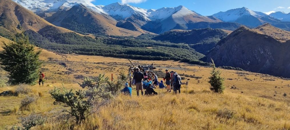
Our morning tea spot was a little further on than usual, but well worth the effort. Enthroned on rocks on top of a hill in warm sunshine, we enjoyed panoramic views enhanced by the blanket of fog below. The going became a little difficult at times, having to negotiate monolithic stone steps designed for giants, and cowpats the size of small coffee tables.

Lunch was enjoyed in another spectacular spot, with the added bonus of being spent in the company of our Alternate buddies who were already making the most of the sunshine and views. Also a pleasure to see soon after was the kereru surveying us haughtily from the skeleton of a once majestic totara. Our leaders guided us ably downhill towards Cooptown, despite there being little in the way of a track. The going became rather muddy in places, but it was the stinging nettle that caused the most consternation (Note to self: avoid, it does not actually sting, IT HURTS!!)

One of our newer members cottoned on to something he really should have noticed months ago; the partner of El Presidente has the mysterious ability to teleport himself repeatedly, so as to be the person at the back holding the gate open until the last tramper goes through, then seconds later reappearing to hold open another gate further down the hill. Just one of his many talents!

After all that mud (and those impressive cow pats) it was a pleasure to slosh through a little stream to give our filthy boots a bit of a clean, before walking quite a distance down an actual road to the bus.  Other than the occasional moan about the stinging nettle, (mainly from me) everyone seemed to be raving about what an absolute joy our little jaunt had been.

Sunshine, birdsong, companionship, and no helicopters needing to be summoned for ankle injuries … who could wish for more. I have elevated my Enjoyment Rating for this tramp in my personal tramp journal to a ground-breaking 5/5, (despite that cursed stinging nettle!).

Camp Saddle 27 April 2022

Group Leader Mentor Understudy Tailender
Stds Warren Chris Jan Brw Victoria
Alternates Norma Wendy A Nick Bev

Stats: Stats: distance 13.4km, ascent 750m, time 4hrs 50mins

Today’s tramps to Camp Saddle (option 1) and Helicopter Hill (option 2) didn’t provide much fodder for this diary writer.  The weather was benign, no one left their lunch at home and the route finding was easy – nothing much to write about!

The big news is that once again the club had a highly successful trip on which 39 trampers had a great day’s walking in the mountains in glorious autumn weather.  Since joining the club in 2015 I’ve completed the Camp Saddle tramp six times and remarkably, the weather has been fine and calm every time!  2022 was no exception – it was a cool start and there were signs of frost on the ground as we crossed Broken River, but the day was sunny and calm – perfect weather for the high tops.

After a 1 3/4-hour trip from Bishopdale, Viktor dropped us off at Mistletoe Flat in the Craigieburn Forest Park and the group of 39 split into two with 20 aiming for Camp Saddle and 19 Helicopter Hill.  After a very pleasant walk through the beech forest that lines the Broken River skifield road, the standard group gained Camp Saddle at 12.35 but decided (a few needed gentle persuasion) to carry on a little bit higher before lunch.  At lunchtime we sat on the 1550 m highpoint of the ridge with a view of the Castle Hill Basin spread before us.  Continuing along the ridge after lunch, everyone safely negotiated the tricky descents and short steep climbs of the undulating ridge, looking out for (and adding rocks to) the rock cairns that mark the route. Soon after 2 pm we were at the top of the scree slope that is the way down towards Lyndon Saddle.  This is the part of the tramp that many relish but which others find rather nerve-wracking.  The opportunity to run down the loose gravel and lose ~200 m of height in just a few minutes is truly exhilarating for some!  This year we had several trampers who hadn’t conquered the scree before, and all accomplished it with aplomb.

After legs had recovered and stones were emptied from boots, it was a short (but steep) walk down through the bush to Lyndon Saddle then an easy 45 minutes down the Mistletoe Track to the waiting bus.

While the standard group was walking the skyline above them, the alternative group walked up the skifield road, along The Luge track to Lyndon Saddle then up to the top of Helicopter Hill for lunch.  After lunch and a tricky descent from the hill (when apparently a bit of controlled sliding was in order), the group returned to Mistletoe Flat via the tracks and road that skirt the eastern and southern sides of Helicopter Hill.  Warren G

Flag Pole-Selwyn River 20 April 2022

Group Leader Mentor Understudy Tailender
Stds Lynne Chris Glenys Wendy A
Alternates Lynley T Ray Pip Marie-Therese

Stats: Stats: distance 17.6km, ascent 594m, time 5hrs

Our bus driver was Alan and we had 46 trampers with no visitors.  On arrival first impressions of Flagpole, an attractive long gradual tussocky ridge to the top, belie the sustained grind of the route the Standards took. The walk followed farm and forestry roads, passed a disused silver mine, climbed up, up and up through forest to our lunch spot.

Walking was hot and made hotter for those of us who’d overdressed. Welcome distraction came from reading Wendy’s copy of Lady Barker’s 1865 account of her Flagpole expedition to see the sunrise. It included a list of food taken: cold leg of lamb, tea, sugar, cake, pigeon pie, two bottles of whiskey and a tiny bottle of lemon essence to make a toddy (a cheese and relish sandwich for lunch now seemed not so appetising).

Further distraction arose from discussion of the merits of sushi for lunch, and preferences for hot over cold rice and how rice might be cooked. Thermettes were fondly recalled. Chris suggested a prototype of his hat for a solar panelled heat source – swiftly dismissed as a potential fire hazard by those responsible for negotiating BTC’s indemnity insurance cover.

Lunchtime was quiet, filled with contented eating. The short following climb was well worthwhile with panoramic views including Mt Hutt, Foggy Peak, The Gap and dramatic cloudscapes too.

With the bus soon visible our descent was quick though loudly shocking at the bottom for one of us who in peering at the swede crop leant too heavily on a fence.

A cheerful group of Alternates maintained a steady pace along the undulating track which occasionally rose above the Selwyn River before our morning tea stop. There was a brief orientation while the leader consulted as to the wisdom of dropping down to the river.

The more experienced walkers remained at the top of the rise before we all continued along the same path. Apart from one minor topple, no walker came to any harm along the way, although a few biting insects were noted. Several head counts were taken by the chief Count, the Tailender having abdicated this responsibility, the number 27 was agreed on, with an uncounted number of assorted poles that aided momentum.

A leisurely lunch was enjoyed at the river’s edge, followed by our return along the same route. A thoroughly enjoyable outing on a warm autumn day.

Txt: Marie-Therese and Jen C

Mt Barrosa-Stour River 13 April 2022


Group Leader Mentor Understudy Tailender
Stds Alan H Dave R Lynne Ailsa
Alternates Norma Leonie Ali Margaret E

Stats: Stats: distance 7.3km, ascent 824m/13km, time 4hrs 30mins

The bus departed at 8.00 am from Bishopdale (instead of the usual 8.30am) and, after a further pick-up at Yaldhurst, we had a total of 48 including Alan, our bus driver for the day.

The Standards were walking Mount Barrosa (a new tramp for the Club) which is an easily accessible peak (1364m) with good views on a fine day out across Hakatere Conservation Park and even to Aoraki/Mount Cook.  Hakatere Conservation Park is centred around the Ashburton Lakes District between the Rakaia and Rangitata Rivers. It covers nearly 60,000 hectares of rugged mountain country, tussocklands, beech forest and sparkling clear rivers and lakes between the Rakaia and Rangitata Rivers.  Seventeen km west of Mount Somers, the Barrosa track starts from a small car park on Ashburton Gorge Road, about 500 m east of Blowing Point Bridge. The car park gives access to public conservation land after a walk of 780 m.

You will note that the spelling of Barrosa differs from the Australian spelling of “Barossa” Valley near Adelaide which is confusing.  Both seem to be named after Barrosa in Spain, the battle site of the Peninsular War by Colonel William Light, South Australia’s first Surveyor General. The Battle of Barrosa was fought on 5 March 1811. Barrosa Station when it was known as Clent Hills, was a huge property that extended from the Stour River valley to the eastern shoreline of Lake Heron and took in the western flanks of the 2333-metre Mount Taylor. When the Clent Hills run was broken up early in the 20th century, the Clent Hills name was retained for the Mt Taylor portion and part of the Lake Heron basin. The remainder (which included the actual range still known as the Clent Hills) was renamed Barrosa. The 25-room homestead was damaged in the 2010 earthquake. When Barrosa pastoral lease completed the tenure review process in 2010, some 4,840 hectares became public conservation land, and the remaining land was sold as a going concern.

As the Alternates were walking the Stour River track, they were dropped off first and the bus continued on a short distance to the carpark at the start of the Mt Barrosa Track. The Standards set off at 10.15am.  Unfortunately, Mt Barrosa was shrouded in low-lying foggy cloud cover so once we started climbing up the well-marked track any views disappeared. Some of us were a little worried about the tramp being a steep climb but were pleasantly surprised that we had no problems climbing up.  The track is 7.3km long with an ascent of 824m to the summit of Mt Barrosa. We arrived at the summit at 12.15pm and sat amongst the rocks eating our lunch looking into the foggy surroundings imagining the wonderful views we were missing out on. It was a little chilly, but the cool wind was doing nothing to shift the cloud cover.

Setting off after lunch we were a little disoriented because we were immersed in fog and couldn’t find the start of the track back down but after some scouting around found the orange pole and fence line. After a headcount to ensure all present and correct away we went. On the way down the cloud cover broke giving us spectacular views before surrounding us again.  Coming down was a little slippery in places with nasty spaniards hidden in the vegetation to make it interesting! We arrived back at the bus at 2.45pm and then drove to pick up the Alternates arriving back in Christchurch about 5.15pm. Even though the weather was not the best we all really enjoyed the tramp and would be keen to do it again, hopefully getting to see the amazing views that everyone talks about. Txt by Judy R

Thirty alternates, consisting of regulars and those disinclined to attempt a steep ascent of Mt Barrosa, set off just after 10.00am. An easy walk along a track parallel to Stour River while hearing the chime of bellbirds/korimako and the zonk zonk of Paradise shelduck/pūtakitaki/pūtangitangi. Rhyolite rock columns made interesting features on the hillsides. Lunch was enjoyed near a fast-flowing ford before we returned, a cool breeze reminding us that the season is now autumn. There was momentary concern/merriment/relief as people resorted to the bushes for a comfort stop only to be told there was a DOC caution alerting of the possibility of live ammunition in the former army training area. All alternates arrived safely back at the bus pickup point about an hour before the Standards. Txt by Marie-Therese.

Prebble Hill 6 April 2022


Group Leader Mentor Understudy Tailender
Stds Chris Alan H Sally Shirley
Alternates Bruce Leonie Ali Marie-Therese

Stats: distance 10.1km, ascent 298m, time 4hrs

With 47 trampers on board the bus we headed west with driver Viktor. Christchurch forecast, rain and southerly late morning.

Jan welcomed visitor Madeleine and said she had great confidence in the Weather Team who promised the rain would clear at Castle Hill late morning plus reminded us of  an early 8am start  for  new tramp,  Mt  Barossa next Wednesday.

Approaching Castle Hill, the rain was more persistent necessitating a decision to

have morning tea at the Community Centre under the shelter of the verandah. After 30 minutes feeling a decision needed to be made Chris stated he would be happy to tramp in the conditions but as Leader felt responsible for trampers if they got cold and wet and announced we would head to the Darfield Bakery.

After travelling only a short distance to our normal starting point miraculously

the skies began clearing and the rain almost ceased. Jan was not afraid to reverse the decision and announce the hike was back on. After perhaps looking like the occupants of a residential home on a bus outing we transformed into a keen agile group of trampers keen to get moving a little late at 11am.

The Standards (22) set off briskly down the farm road followed closely by the Alternatives (25). A new temporary bridge across the Porter River allowed us all to keep our feet dry. Velvet   black   steers   looked   striking   against   the   landscape   and   with   more patches   of   blue   sky   appearing   it   wasn’t   long   before   jackets   were   being removed. We left the road, crossed grassy paddocks, followed a fenceline and re-joined the road towards the base of Prebble Hill. A final steep grassy trudge to the summit, which we reached for lunch at 1pm. This is a truly magical place with all its limestone rocks of such incredible shapes, ideal perches for lunch to take in the awesome views of the Broken River area.

​Reluctant to move we made our descent through the monoliths and giant boulders, some   having “Lion   King” moments   and   others   could   feel   the adrenalin pumping as they looked at the anchors left on those vertical rock faces by the abseilers.

We had been warned about the matagouri as we made our way steeply uphill once we reached the Porter River, back across the bridge before the final hill to the bus which we reached at 3.10pm. approx. 15mins after the others. The Alternates who had followed the same route had found an ideal lunch spot about 10 mins after leaving the road towards the base of the hill.

The two Weathermen were the Superheroes of the day as without their persistence we may have only got as far as the bakery.  Txt by Kate

Bellbird to Evans Pass 30 March 2022

Group Leader Mentor Understudy Tailender
Stds Dave R Chris Sally Jen
Alternates Ray Margaret S Eric Ali

Stats Standards: Distance 18kms, Elevation Gain 410m, Duration 5hrs
   Alternatives: Distance 14.4kms, Elevation Gain 326m, Duration 4hrs 20min

A long walk, but a good walk with nothing too strenuous and with views over both the city and the harbour ensuring that the 41 on the bus were looking forward to the above, plus the fresh air and companionship provided every Wednesday.

Our visitor Madeleine was welcomed, and driver Alan had us on our journey promptly. It was a novelty to be heading towards the Port Hills and the Summit walkway. The road works on Dyers Pass Road had taken many months but made for a less-hair raising journey as we made our way upwards road cone-free. However, the narrowness of the Summit Road saw a few inching toward the middle of the seat and as far from the view over the drop-off, as could be managed.

(This is now 129 words and having been admonished by Chris, not once but twice, to keep it to 350, I am half-way to being finished. I am wondering if previous writers have been similarly cautioned, or has my penchant for using ten words when one will do, caused me to be singled out?) [The answer is yes! And a deadline of Sunday or earlier is appreciated.]

The Standards were dropped at the viewing point above the Sign of the Bellbird and made good time to the Kiwi, enjoying morning tea there before continuing along Mitchell’s Track and the Summit Walkway.  Meanwhile, the Alternates were enjoying their stroll, with Basil having an unexpected meet-up with his daughter along the way.

At some point the Standards’ leader, Dave decided that walking on the “closed” section of the Summit Road was a treat we deserved and putting reservations aside we dutifully followed him onto the sealed surface. Walking in the middle of the road into blind corners required us to set aside survival instincts honed over many years, when sure enough we heard the unmistakable sound of an engine approaching from behind.

The two former school principals, freed from the constraints of the NZ Education Act and the abolition of corporal punishment, debated that a walking pole thrust through the wheel of what proved to be a motorcycle, would be a fitting punishment for the rider.

It seems that both groups had an otherwise uneventful day – no trips, slips or other excitement, thank goodness.

Your author, overhearing three walkers behind discussing cuisine has learnt that the best Thai peanut satay in Christchurch is a No 20 from …. Oops! Sorry, I have exceeded 350 words. To be continued next year.  Txt by Jan Brw

Mt Alford 23 March 2022


Group Leader Mentor Understudy Tailender
Stds Peter Alan H Kate Judy
Alternates Liz Margaret S Ali Bill W

Stats Standards: Distance 9km, Vertical Ascent 730m, Time 4hrs 45mins
   Alternatives: Distance 5.72km, Vertical Ascent 376m, Time 4hrs 30min

A greyish day greeted the start of our long bus ride to Te Maka Kaha/Mount Alford in the Ō Tū Wharekai/ Ashburton Lakes District. Amid the hum of morning chatter President Jan B welcomed new club members. There were 41 trampers for the walk. James was our driver.

A little context from a Google search: Alford Forest was named after Lord Alford, a member of the Canterbury Association.  To date have found no evidence of his having done this walk or of his visiting Aotearoa New Zealand.  Ō Tū Wharekai is an area of immense cultural significance to Ngāi Tahu, being both an important seasonal mahinga kai/ food gathering area and a major travelling route between settlements on the east and west coasts.

A stop at the almost brand spanking new Rakaia Salmon Site public toilets – resplendent with dazzling white tiles and terrazzo benchtops – on SH1 was a highlight (Cost of upgrade to reserve including toilets, playground, landscaping and solar-powered rubbish bins $958,000. Source: Ashburton District Council). “The best public toilets in the world” said one user.

The walk began with a farm track before entering Mt Alford Scenic Reserve. This is lovely mountain beech forest and birdsong walking. A series of stiles and gates and the accompanying gatekeeping made for changes in walking order. There were several changes during the day with walkers opting in and out of continuing up the hill. Reflecting on it during the walk – accommodating people’s walking enjoyment on any one day is a very real strength of walking with BTC. As a relatively new member to the club – thank you.

Recent wet weather made for muddy walking in patches. Some of us initially tried to keep our boots clean. Ha! This was not successful. The day had cleared, and it was hot work grinding up the hill following fences and marker poles. Also challenging were crowds of midges – possibly thrips pollinating dracophyllum flowers.

The Standards lunched beside the cairn amongst the snow tussock at the top where happily there were fewer midges and a 360-degree view of the inland mountains and the plains. Lunchtime conversation turned to Wordle and Kaye’s recent inspired one attempt solution. Brilliant. Talk moved to mad muddy marchers being munched by midges while lunching on marmite sammies on a mountaintop. It was all downhill after that.

The return walk was something of a scramble with concentration required for firm footholds and it was muddy. Where there’d been some attempts to control the amount of mud on the ascent on the way down resignation and eventually childish glee were the order of the day. Fun.

Thank you all for another very enjoyable day out of the city.  Txt by Jen

Roto Kohatu Reserve-Willowbank 16 March 2022


Group Leader(s) Tailender
All Ray, Jan Bbr, Nola, Dave B Janice

Stats: distance: about 14.5km

With persistent heavy rain forecast for the 13 Mile Bush area, the planned destination for today’s tramp, Plan B was put into operation: Roto Kohatu Reserve to Willowbank.  Thirty-one members including visitor Steve G joined driver Alan at Bishopdale for a brief ride by coach to the western extremity of Sawyers Arms Rd and the entrance to Roto Kohatu Reserve.  A meaning of the Māori word ‘roto’ as a noun is ‘lake’ and meanings of ‘kohatu’ include ‘stone’ and ‘rock’, which presumably refers to the origin of the lakes in the reserve as gravel pits.

By 8.45 am, we were off the coach and, with packs on our backs and a grey sky above, we set off into the reserve and followed the path round the west side of the lake complex (Lake Rua, Lake Tahi and the canoe polo area).  After a couple of back-tracks, we proceeded round the Isaac Farm Loop and, at 9.45 am, had morning tea at a nice spot on the bank of a clear stream – the early arrivals were able to make use of a memorial, outdoor wooden table and the rest either stood around or found a suitable perch of some kind.

As we got ready to leave this spot, there was some fine drizzle so many raincoats were put on, but they were soon discarded because the shower quickly petered out.  As we were walking along the track, two gentlemen and a little dog came walking towards us.  As they got closer, we could see that they were the well-known Nick Atkins and Stan Darling – some brief verbal exchanges followed.  We then followed the Otukaikino Track through the Clearwater complex to The Groynes.  By now the weather had really changed and there were even glimpses of blue sky! (However, they were not to last!).  A bit after The Groynes we stopped for lunch at 11.50 am and those who had taken their raincoats off had to put them on again as we experienced a bit more than some drizzle.  After a walk alongside the motorway by-pass, we were back in civilisation where our leaders pointed out the Kaputone Stream.  During all of the walk there was a lot of evidence of planting of native vegetation – one notice claimed that it was to help improve the quality of the streams though all the ones we saw seemed very clean and clear except, perhaps, for the amount of floating vegetation in many areas.  We did not see much wildlife except for some pukeko and a harrier but that situation should improve for our great-grandchildren given the native planting that is being done.

The walk continued through a number of the streets of the Northwood suburb where many gardens received favourable comment.  Eventually, we made it to Hussey Rd and walked along it to just after Willowbank Wildlife Reserve by 1.05 pm to find Alan there waiting for us.

Those who were new to the Roto Kohatu Reserve area and for any others interested, particularly in freshwater sports, the City Council is currently open for submissions on how the area should be developed and upgraded.  The closing date is 28 March – see the city council web site for further information (Roto-Kohatu-Reserve-Development-Plan-DRAFT-2021-11-22.PDF (ccc.govt.nz)).

Txt by Margaret & Eric

Peak Hill 9 March 2022

Group Leader Mentor Understudy Tailender
Stds Dave R Warren Nicky Veronica
Alternates Ray Alan H Liz Linley T

Statistics:
Standards: Distance9.5km, Elevation Gain: 650m, Time: 4hrs 20mins
Alternatives: Distance: 7.69km, Elevation Gain, 364m, Time, 4hrs 17min

A gorgeous day opened up as the bus of 42 (including 4 visitors: Tony, Daphne, Hetty and Pip) with new driver Dave arrived at Peak Hill D.O.C. track.

Seventeen standards headed off up Peak Hill Track initially lead by Chris, who kept us at a cracking pace until we stopped for morning tea just under the first ridge.  We gazed out at the beauty of the land below – the Braided Rakaia below us and Lake Coleridge to the left with farmland woven along the base of staunch rounded hills and peaks.

After morning tea Dave R. took over the lead as Chris was feeling a bit knackered and decided to make his way slowly back down to the bus (probably the result of that steep climb at the beginning and some new meds).  [He quite enjoyed the superb east/west views from half-way down the slope while having a very leisurely lunch, getting back to the bus not long before the Alternates. President Jan did remind him of the by-laws and the need for someone to accompany him; but he did not want to hold people up or spoil somebody else’s day.]  

Dave led us upwards over several humps, each deceivingly suggesting we were arriving at the top. Finally, a group of stones greeted us at the top.  After a photo we settled down for lunch looking up towards the mountains, some with a little snow. The sun was shining and there was a slight breeze.  What a picture-perfect view of braided rivers, humpy hills, faraway mountains of the Main Divide and green manicured valleys.  Stunning!!!

After lunch we headed over the hill and lined up with an old fence that went straight downhill towards Mt. Oakden.  Low scrub, matagouri and Spaniards mingled with gentians were scattered around us.  Alan H. (who had been trimming the lower track for the Alternates) came up to meet us and guided us to the corner where we met the track. This lower track was a mixture of bracken, muddy areas, slips, stumps and holes.  We had to watch our feet all the time.  

We arrived at the bus soon after the Alternates. A very pleasant day. 

Txt by Nicky

Tiromoana Bush Walkway-Kate Valley 2 March 2022

Group Leader Mentor Understudy Tailender
Standards Wendy A Peter Gary  Judy R
Alternates Leonie Norma Linley Maureen C

Stats: Standards: Distance 12.8km, Vertical ascent 424m, Time 4hrs 25min
  Alternatives: Distance  11.27km, Vertical ascent 434m, Time 4hrs 18min

Being the last to get on the bus, maybe arriving at 8.31am, I was immediately seconded as today’s diary writer, I think as a reaction for my lateness? Passing down the bus and looking for a safe refuge, I sat myself next to Gary and after chatting for a while he told me he was on the weather team for this outing. Looking out the bus window one could observe the precarious state of the weather with dark clouds overhead, but the call had been made for the green light to proceed with the potential promise of the weather clearing in the afternoon. A little later in our conversation Gary mentioned the possibility of rain for about an hour around lunch time and so it proved that Gary was really on-to-it.

In the interim vice president Bev took the microphone, possibly for the first time, to welcome us all, introduce our visitors, and to inform us of the 2 leadership teams, which she did, I think, with great aplomb.

The welcome at Tiromoana car park, arriving around 10am, was punctuated by a fair amount of dampness underfoot with various trampers deciding to wear their raincoats from square one but with me choosing 3 layers with my polar fleece on top. However, trampers tumbled out of the bus with their usual enthusiasm as if it was a lovely summer’s day and Wendy was the standard’s leader and after a short walk down the starting path, we were directed to pass through a deer fence gate, this built suspended into the fence and so requiring us to step through it: feet up, heads down, and backpacks off, 20 standards followed by 19 alternatives! We proceeded along a wettish grass path, the Te Ara Tawhai track, mainly descending to our tea and biscuit break at the look-out, this affording good views of the surrounding areas but being aware that our destination included the further off coastline with the need to get there but not before climbing Ella Peak. According to the map, this peak has an elevation of 346m and takes 50min return but helped by the fact that we could leave our bags to be picked up when returning down the same track.

The alternates also commenced this climb, but their leader Leonie led us to the Te Ara Kānuka track and as the name suggests it was a large stand of kānukas. The track weaved between the bush and soon we met up with the main walkway. A nice diversion from the usual track. During the walk down the road to the ford we passed a paddock of plants with a very strong smell, this turned out to be fennel and some members remarked it smelt like curry powder.

Upon returning to our discarded backpacks some decided to again put on their raincoats as rain was in the air but with me taking the gambol it would stop and so stuck with my polar fleece option. However, my unusual optimism proved to be unfounded, so after about 20min of walking in fairly light rain decided to put on my raincoat which proved just as well as Gary’s anticipated hour of rain more or less eventuated as we proceeded our descent to our coast line lunch stop when thankfully it stopped raining and we precariously seated ourselves on various log debris to eat our lunch in the presence of a cool breeze and noting that Norma in her usual organised manner was sitting comfortably under her umbrella already enjoying her picnic!

Our return via Tirimoana Track passed a conveniently situated portaloo and the nearby farm and can be described in simple terms as “uphill”! But the track took us through a lovely, forested area where we passed various fantails which entertained us with their hovering aerobatics and song.  The walk up the hill to the bus was completed without trouble, the standards uniting with alternatives, but no one was worried and just happy to be back at the bus.

For my money the weather team made the right call as we had all dried out by the time we got to the bus, roughly at 2pm. We all had a great day!

Keith L & Ray B