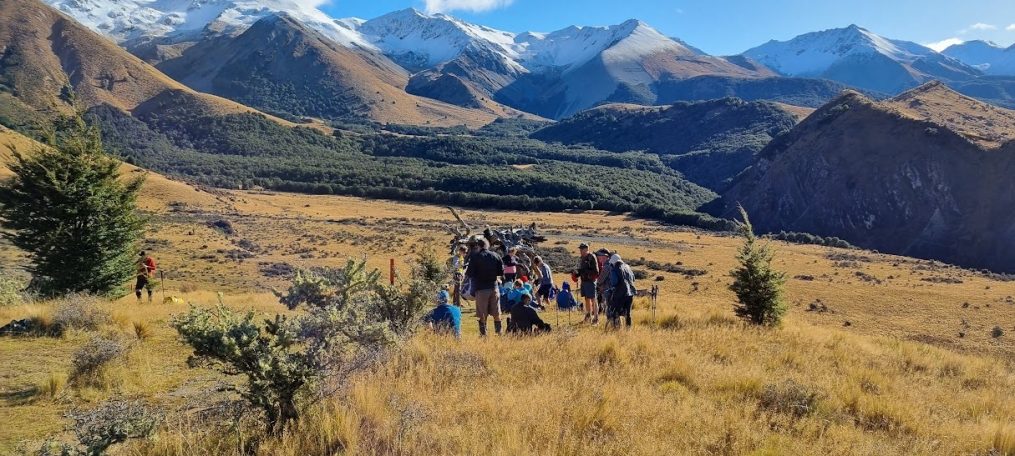
Bellbird Loop 23 April 2025

Leader Mentor Tail Ender
Standards & Alternates Alan Selwyn Judy R

Distance 8km, elevation gain 485m, time 4hrs 20min

24 trampers braved the morning’s cold, windy and damp weather spilling over from Easter’s deluge.  After an initial “false start” resulting in 20 minutes’ delay, the bus delivered us to the Sign of the Bellbird car-park around 10:00am. The decision was then taken to combine the standards and alternates into one group for the day’s hike.

We commenced walking on the western loop, taking Orongomai track, descending 200 metres in muddy and slippery conditions on the track – some care with footing was needed. On the way we experienced some birdsong from the odd bellbird, sightings of a fantail and significant waterflow in the two adjacent gully creeks.

We arrived back at the Bellbird at around 11:30am for our 20 minute morning tea.

After our break, in improving weather, we crossed the Summit Road to the harbour side, heading south towards Cass Peak on the Cass Ridge Track, encountering a half dozen or so walkers ascending from Governor’s Bay.

At the bush gully sign we turned north, descending 280 metres or so, then sidling along the lower slopes for about 1km on O’Farrells track.

At the junction of the Bush Road track we began to climb again. After ascending for about 100 metres we were able to stop for lunch at 1:30pm in the sun, at a point with views over the harbour from Governor’s Bay and Allandale.

At about 2pm we were climbing again towards the Bellbird on the Bush Road track. At the Summit Road the standards took Ella’s track, and the alternates, the Crater Rim Walkway, both groups arriving back at the Bellbird about 2:30pm having completed the eastern loop.

Text by Stuart C

Flock Hill 16 April 2025

Leader Mentor Tail Ender
Standards Alan Graham Brent
Alternates Pip Chris S Tessa

Standards: Distance 11.3km, elevation gain 480m, time 4hrs

It was 40 eager trampers including visitors, Neville (Janne’s husband) and Taylor, that boarded the bus with driver Alan heading west for new tramp, Flock Hill, under gloomy skies. Megan and Mark generously provided “Tariff Candy” wishing everyone a Happy Easter before they head to the wild west on holiday.

Today the land at Flock Hill, so named as in the distance the limestone tors resemble flocks of sheep, is owned by Canterbury University but leased to a manager, LLC, a group of mainly American investors who have developed the luxury lodge. The farm, 36,000 acres with 10,500 merino romney sheep and 400 cattle, is managed by a NZ couple who have kindly granted us access to their station.

At 10.20, 29 standards left the lay-by on highway 73 to walk along the fence line of a seriously fire damaged paddock to join the farm road heading downhill to get amongst the limestone tors. Morning tea at 10.40 on a grassy bank felt early especially when the 11 alternates walked briskly past heading for a grassy patch further on.  We made our way through a broad gully of rocks of every imaginable shape with the weather brighter and little wind, perfect conditions for hiking. The view of Prebble Hill catching the sunlight and the Porter and Broken Rivers was awe inspiring. We reached the ridge for lunch at 12.45 and the alternates, who had taken a slightly lower path below the ridge, enjoyed their lunch still fully immersed in the cool rock vibe.  Alan sprang a surprise for the standards after lunch: one more uphill section to reach a cairn, the official highest point. We passed a man standing on top of a fairly vertical rock but of course with a good woman below holding a padded landing pad.

Two movies were shot here, The Lion the Witch and the Wardrobe, and last year, Bookworm, which is a tween family friendly adventure movie.

We were back at the bus with the alternates at 2.30 after taking a different route downhill, managing to remove stubborn wilding pines on the way. Thanks to this year’s team who had a far gnarlier task than previous years.

To stay at the lodge is $12,000 a night but there are now seven new villas where you can stay for $3956 which includes all meals at the new restaurant and two activities. Please pay BTC sub before surprising someone.

After a refreshment stop at Darfield we were back by 5pm with a resounding thumbs up for the new tramp.

Text by Kate


Weka Pass Farm 9 April 2025

Leader Mentor Tail Ender
Standards Judy R Chris S Frank
Alternates Wendy Ali Moira

Standards: Distance 14km, elevation gain 513m, time 4hrs 30mins

Alternates: Distance 10 km, time 4 hrs

“Easy, undulating, farm tracks, great views”.  That sounds a pretty idyllic walk!

After departing Bishopdale we picked up two strays in Woodend and became a total of 43 willing walkers, keen to undertake this North Canterbury farm outing, in an area not generally accessible to the public. Our driver was Garth, there were 28 Standards and 15 Alternates with three visitors, Diane, Richard and Taylor joining us. Chris H brought along chocolates, always good to celebrate another year, a welcomed treat.

Setting off from the bridge over a very narrow chasm, our boots walked in easy rhythm traversing ancient paths that were first explored by Maori approx. a millennium ago. Not a dinosaur in our group of many retired people – we are more like the feisty and curious weka (DOC bird description). No weka seen today, but a pair of magpies and a hawk soared on a thermal. Also sighted were flocks of sheep, white butterflies on the brassica crop, lots of cow dung – mucky on boots – lush rolling farmland, stunning limestone country.

The “trolley problem” was considered in light of the three gate question, which one to take, what might be the consequence of going through a different gate? The Alternates were definitely on the right path, the Standards were more challenged in choosing, with some strong consultation as to which to follow. Standards also took a longer route, up, over and along different farm tracks.

However, all tracks eventually led to the Old Weka Pass Road and the waiting bus, though not before the Standards had the under or over gate dilemma. Some slimmer members were able to squeeze under the locked white gate, while others clambered over. Fortunately the obstacle was circumnavigated before lunch. Both groups had lunch stops at different barns, the Standards’ one a bit barren, while the Alternates sat comfortably on hay bales or stacked wood. We all bypassed the distinctive deteriorating sheets of metal – more sculpture-like than storage.

Finally at the bus, the Alternates were able to offload the Mega Nuts Chocolate Bar which had been inadvertently left behind on the hillside. The owner of this was deduced from close scrutiny of a photo taken at morning tea. Despite the dramatic views, good company and conversation, alas, there had been a (brief) discussion on divvying up the chocolate bar – or not.

Standards arrived at the bus about 30 minutes after the Alternates. With the early completion of the walk, there was time for a short stop at Amberley to round off another day of adventure with BTC in the great outdoors. Idyllic indeed!

Marie-Therese

Hinewai Reserve 02 April 2025

Leader Mentor Tail Ender
Standards Alan Brent Shirls
Alternates Pip Ali Sally

Distance 12.5km, elevation gain 640m, time 4 -5hrs

This is a popular tramp, which was missed last year due to poor weather, and 38 trampers signed up. However, unfortunately 3 withdrew at late notice for various reasons.   Due to the distance to Hinewai, we had an 8am departure from Bishopdale with a pick up for others at Halswell.

President Jen had advised us that a viewing of a documentary titled “Fools and Dreamers” prior to this tramp, would be informative with regard to understanding the genesis of Hinewai and the work of its brilliant and somewhat eccentric kaiwhakahaere Dr Hugh Wilson.

While travelling in the bus to Hinewai, our club member, Bruce Hansen, who is a long-standing Trustee of the Reserve, gave us an informative background to the origins and development of Hinewai since its formation in 1987.  A chance meeting of botantist Hugh Wilson and philanthropist, Maurice White, provided the spark which enabled it to get underway, with the purchase of 109 hectares of land.  It was non-productive pasture covered in gorse and with Hugh’s idea of minimum interference and letting nature do the regeneration work, Hinewai now has 1600 hectares of regenerating native forest.  While eradication of pests has been a big job and remains so, Hugh’s practice of allowing the gorse to grow and allowing nature to return its seedlings to the Reserve to be ‘nurtured’ by the larger gorse cover, has been very controversial.  However he has proven that the native trees, in relatively short time, outgrow the gorse and kill it off, providing a wonderful forest floor nursery bed for seedlings.  Local farmers and indeed the Environmental Council, with their noxious weed legislation, were not convinced early on and Hugh has fought many battles over the years and won.  Hinewai today is the evidence that it works.

Alan and Jan B had done a prior walk to establish the best route for our groups and we all took off from the Long Bay Road carpark under grey skies and in a stiff, cool easterly. Some of the early gradients were quite steep and slippery and there were numerous falls as we made our way to Jules’ Knob for morning tea.  Apparently this was named after famous Peninsula identity and rugby player, Jules Le Lievre.  It was a rugged knob, worthy of its tough prop namesake.

Hinewai has an extensive network of tracks and we proceeded down Kereru Track towards Long Bay, encountering impresssive bird life.   Continuous serenading by korimako was accompanied by aerial ‘attacks’ by squadrons of piwakawaka, scooping up the insects the group was disturbing.  Nature has done a superb job of reestablishing the forest and there is a wide variety of NZ natives, from the podocarps to the smaller shrubs and bushes. There was some discussion about the food quality of the kawakawa leaves, with the suggestion that those with holes in them must be the most desirable since the insects found them so tasty.

Lunch was taken down on the beach, where a group of retired UC chemists were also having lunch.  This stimulated a discussion about the fact that a number of our trampers could recite the Periodic Table.   No competition with the chemists was contemplated!

The return journey started back the way we came, but we then diverged up the Valley Track, through many more hectares of this inspiring example of how nature can restore a forest, if left alone to do so.  After the big climb up from the beach, we were all glad to see the Visitor Centre and Hugh’s house hove into view, with the bus just a bit further on.

Bruce dealt with a few more questions as the bus descended back into Akaroa and we passed Hugh, pushing his bike up the hill back to his beloved forest, of which he is so proud.

Text by Selwyn

Castle Hill Village to Kura Tawhiti via Leith Hill Slump 26 March 2025

Leader Mentor Tail Ender
Standards Selwyn Chris Joanne
Alternates Michele Ali  Marie-Therese

Distance 9.5/8.8km, vertical ascent 338m, time 4hrs

The walk to Leith Hill Slump and on to the limestone rocks at Kura Tāwhiti (Castle Hill) is a favourite of mine and it must be a favourite of many in the club because our bus was full with 48 trampers on board.

The day was fine and sunny, and the temperature was good for walking – not too hot and certainly not cold.  A light northeast breeze refreshed us.

The leader of the standard group of 31 was Selwyn and in a break from tradition (!!) he began the day with a short briefing on what we could expect.  He asked how many hadn’t done the walk before and then assured them (and the rest of us) that they were in for a wonderful treat.  We were to expect beautiful native bush, plenty of birdsong from the resident korimako (bellbirds) and great views when we got above the bush line.  Selwyn explained the route to be taken noting that we’d begin by following the Hogsback Track then some logging tracks through beech forest before morning tea at the Thomas River.  Lunch would be at the Leith Hill Slump after which we’d sidle along the lower slopes of Leith Hill and out to the highway at the famous limestone rocks at Kura Tāwhiti.

And it all happened as Selwyn enthusiastically predicted!

The alternative group of 17 followed much the same route except that at the start of their walk they bypassed the meander through the logging tracks and the Thomas River in favour of a more direct attack on the steepish climb up to the lunch stop.

Something I looked for as we emerged from the bush just before lunch was any noticeable sign of the devastating fire that burnt just north of this area for five days in December last year, but we were too far away to see anything. The views closer at hand of the Castle Hill basin were great although not as spectacular as when doing this walk in winter surrounded by snow-capped peaks.

As the standard group arrived at the slump just before 12, the alternative group members were swallowing the last of their lunches and they soon headed off to get a head start on the second part of the walk. They kept up a brisk pace because we standards didn’t manage to catch up with them until right back at the bus.

Apart from Selwyn’s enthusiastic briefing at the start, there were no dramas to report – just a very pleasant ramble through the bush and farmland (with permission) of the Canterbury foothills.  The alternative group experienced something of high-country farming life at the end of their walk when they met a large flock of sheep being herded expertly by Castle Hill Station staff and their trained sheepdogs.

After a stop for refreshments in Darfield we arrived back at Bishopdale at about 4pm. A successful day out. Thanks to the many club members who planned, organised, and led the trip.

Text by Warren

Kowai River 19 March 2025 (Cancelled)

Kowai River – the alternate tale of a cancelled tramp

The club was booked for 39 members to walk to Kowai River. The weather was not co-operative for this week (again…) and thus at 0645hrs, this member looked at the cancellation message and went back to sleep.

It was thus with a great surprise that it was 0915hrs when the member again awoke. This is definitely an irregular occurrence, but can be handled with a degree of nonchalance. Followed by a leisurely breakfast and diligent reading of The Press.

So what to do, instead of walking along a 4WD track with the alternates along the true right of the Kowai River (true right being the right bank when facing downstream)? Of very great interest was the return of the astronauts from the International Space Station, two of whom had been stranded in space for nine months. It was breath taking to accompany from afar and watch the drogue parachute deploy and read that Donald and Elon had (apparently) been instrumental in this safe return (?!?). The AI display didn’t quite match the commentary, which was distracting as there was some simultaneous muffin making going on.

But there they were, there they had been, and now they’re back on Earth. I had a lingering curiosity as to what exercise had been done in space, and how they managed to retain a degree of sanity from having been confined for so long. My days out in the hills with a wide variety of companions and conversation are far preferable to being so restricted, though I’m a bit too old for space travel.

Anyway, I was going to be trip writer today and regale a tale or two of the walk to the John Hayward Hut. Instead, I shall leave you with an historic tale of this area, as allowed by the duties of trip writer.

In August 1976 a foursome set out along the Kowai River to do a winter climb of Mt Torlesse. There was a strong nor’west and from the city, the mountains looked inky black. As the weather began to close in, the two women in the party retreated. The menfolk carried on, as menfolk are wont to do, with no discussion or yielding to inclement conditions. The womenfolk waited at the little red roadman’s hut at the bottom of Porters Pass. They waited and they waited, and eventually notified Police that two of their party were overdue on Mt Torlesse.

As written, the weather was not good. In fact, the weather was so appallingly bad on Mt Torlesse that the menfolk reached the top in a blizzard. After several attempts to descend in whiteout conditions, and knowing that there were broad ridges which ended in bluffs, they decided that the best thing would be to wait out the storm. Both were experienced trampers/climbers so utilising their ice axes and a billy, they dug an ice slot near the lee of the summit and lined this with packs and some plastic, topping it with a carry mat which was covered with snow.

The piece de resistance was anchoring an ice axe in the snow at the summit with the billy a’top, and running a climbing rope down to the shelter. The duo then squeezed into a sleeping bag that had been stowed in one pack, and enjoyed a couple of peanut bars, limited rations indeed – after all this was a training trip for a proposed walk in the Himalayas. Carrying a billy and a sleeping bag on a day climb of Mt Torlesse was probably excessive but fortuitous.

Of course, Search and Rescue was deployed, and after a very anxious night for the womenfolk, several groups were out from daylight searching the surrounding areas, with a base at the roadman’s hut. The Face Rescue team was flown as high as possible up the peak. Members of this team climbed to the summit and found the billy, ice axe and snow encrusted rope leading down to the ice slot. The two men were essentially OK though cold, but pleased to be escorted to the waiting helicopter, and soon safely delivered to the women still waiting at the red hut.

One of the men didn’t go on the trip to Himalayas, reconsidered the idea, and instead ended up getting married a few months later to the trip writer who had been waiting at home through the drama. The incident was a watershed moment (for the couple), but was never followed by an attempt by me on Mt Torlesse, nor a walk along the true right of the Kowai River. Forty-nine years later and the weather again didn’t work out. I did however manage a nine km walk to visit a friend.

Text by Marie-Therese

Wilding Pines 11 March 2025

A few weeks ago, Chris S issued a call to arms (well, saws and loppers actually) to mount another attack on wilding pines (Pinus Contorta) in the Waimakariri Basin and 5 carloads of trampers headed west, keen to lay waste to the pesky blighters. They are extremely invasive and ECan has been working to eradicate them for many years using aerial spraying, commercial firms and volunteers like us. The Bishopdale Tramping Club is one of many organisations helping in an area where we do about 8 tramps each year.

The area was on the south end of Flock Hill where it borders Castle Hill, some distance back from the road and in a different area to previous missions. On the side of the track was a Battlefield sign which, your scribe assumes, was an area used in the Lord of the Rings movies. The limestone was truly spectacular with one long high ridge looking like the battlements of a large castle.

But we were not there to gawk at the scenery – there was work to do. And what work it was! It soon became apparent that the pines would not be a pushover as in the past. They would require a lot of effort and steely resolve to remove them. Even the small ones could not be pulled out with brute force. Many were around 2 metres tall and finding the base was just the first issue. They had to be sawn off at ground level and all traces of green pine needles removed. Jan M and Chris S surmised that they had been grazed by deer so the pines had toughened up.

The calls for morning tea and lunch were eagerly received but when the final whistle went at around 3pm there was a collective sigh of relief. It had been slow, hard progress but we could see where we had removed quite a few trees. On the positive side, we left enough trees for another group of volunteers. We just hope that happens before the next call to arms.

Text by Peter M

17 Volunteers coordinated, 4 high-clearance vehicles provided, a day suited to everyone, fine weather, a location teed up – ducks in a row, good to go.

Having met up at Yaldhurst for a final check-in we were on the road to Castle Hill Village to meet up with Ray Goldring, Deputy Chair of WELRA (Waimakariri Ecological and Landscape Restoration Alliance), to collect loppers, saws and hi-vis vests.  He was going to guide us to our pine patch on Flock Hill Station.

It is interesting to note that the main wilding pine is Pinus Contorta but basically any pine tree growing wild can be a pest; but contorta is the worst as it establishes very quickly from wind-blown seed and is able to soak up moisture like a sponge – ready to bear cones and potentially seed again rapidly after about four years.

Having negotiated a winding rutted shingle farm road which eventually petered out into a rough grassy track, we arrived at our very scenic spot for the day.  We gathered round for Ray’s instructions, gathered up our gear and got to work.  The first of the noticeably vibrant green trees were easy enough to deal with but as the day progressed, they became much gnarlier and harder to fell, even with the big loppers or a saw.  It was hard going but after a lot of b, s and t – all persevered.  Morning tea and lunch breaks were certainly a welcome respite.  About 2.30 we called it quits and headed back to report progress and explain the nature of the trees that maybe would need some heavier hitters to eradicate.

Everyone enjoyed the day including one of BTC’s longest-serving trampers 92 yr old David Eddy (one of 5 Davids on the day!) who first started his wilding pine volunteering back in 1989 and who had not been back long from a cruise in Antarctica.  Remarkable.

Our effort to get rid of these pesky pines is always appreciated is as the $830 payment to the club received from WELRA.  Join up next time for the next pinus contorta adventure in a place that may be off the beaten track like this one.

Text by Old Boots (Chris S)

Boundary Hill 5 March 2025

Leader Mentor Tail Ender
Standards Alan Jan Br Joanne
Alternates  Peter M Ali  Kiwan

Distance 11.5/7.6km, ascent 519m, time 4hrs.

Other than the usual boots, pack, lunch and water, what else might be required for our Boundary Hill adventure today? Long sleeves and long pants for the prickly matagouri and Spaniard plants – tick. Beanie and gloves in case it’s cold – tick. Sun hat just in case it’s hot – tick. A good jacket for possible rain – tick. A pole for the very rough terrain – tick. And for one of us, a bunch of festive-looking orange ribbons – more on them later.

None of these items looked like they would actually be required as the weather soon deteriorated from a bit dodgy to bad as we travelled away from our second pick-up stop, Yaldhurst. Would this be one of those incredibly rare days when our little bus with 30 hopeful trampers trundling over Porters Pass might have to turn back without having walked a step? The day had already started badly when Some Problem To Do With An Engine had delayed our bus’s departure by 15 minutes. The fresh snow on the mountains was mildly concerning – but those dark rain clouds ahead were even more of a worry.

But of course, it takes more than a few looming clouds and a nip in the air to deter our well-equipped, enthusiastic bunch of trampers, so soon after arriving at our drop-off point on the Lyndon Road the two groups set off towards Boundary Hill.

The swampy parts weren’t as boggy as they could have been and the matagouri didn’t deter us, though it did try. The terrain where the Standards stopped for a (late) morning tea was like a giant rock garden planted out by an unimaginative landscape gardener. Words of wisdom of a botanical nature given to an almost-kiwi tramper: if it’s a little plant, it might be a hebe. If it’s taller, let’s call it a pittosporum. And if its tall like a tree …  well, it’s a tree.

The going became tougher and every footstep had to be a considered one. Ali must have momentarily forgotten this as the other 12 Alternates had a ‘Where’s Ali?’ moment when all they could see of her was a glimpse of a wrist and hand before she emerged, unharmed, out of the hole she had fallen into.

Someone who impressed the Alternates with her initiative and abilities was visitor Lynne H, helping others getting across the ‘crevasse’ along the way. We hope we have the pleasure of her company again soon. It was also great to have David back with us again after returning from the States.

Boundary Hill is a different sort of tramp from many others that we do because there is no clear track to follow, and there are no marker poles or signs. Which clump of matagouri should we head to next? Ah, that’s where those pretty orange ribbons came into it – leader Alan was following the faded ribbons kindly tied onto clumps of matagouri by Bishopdale trampers in the past, while frequently tying on plenty of bright new ones for the rest of us to follow. Ever helpful Snipper Brent did some of his magic too with his handy-dandy secateurs.

Lunch for the more energetic half of the Alternates and all the Standards was on top of Boundary Hill. I Googled it, and found Mindat referred to the hill as ‘An elevation standing high above the surrounding area with a small summit area with steep sides.’ It didn’t mention the panoramic toward the peaks of the Main Divide up the Rakaia Valley and out over the Archeron and the Rakaia Gorge area to the south, and that startling blue of Lake Coleridge. Most of our beanies, gloves and even jackets had long since been discarded and it was very pleasant on top of that small summit.

However, before long all the Alternates headed back the way they had come, following those pretty orange ribbons, and the Standards continued on. A surprising highlight on the way down had to be Alan’s discovery of Ron. Ron had a terrible head injury. Ron was dead. Ron was a weasel – well, Ron Weasel sounds a lot better than Ron Stoat so we’ll assume that’s what he was. Regardless, Little Ron’s fur was beautifully soft.

Everyone seemed to be enjoying our Boundary Hill walk, despite the rough terrain. Where else can you traverse an alpine fault (the Porters Pass fault), gingerly edge your way down from the top of a lunar-looking landslip, and see beech trees flourishing on a scree across from a Red Lake? (I didn’t Google how the latter got its name, but my guess is that the names Blue Lake, Green Lake and Emerald Lake had already been taken).

The Standards made good time downhill and had a pleasant, leisurely wait for our bus driver David to arrive with the Alternates already on board before heading back to town.

Text by Shirls


Sign of the Bellbird/Kiwi to Evan’s Pass 26 February 2025

Leader Mentor Tail Ender
Standards Graham Brent Jan Bw
Alternates Ali Ailsa Michele

Distance: 18km

After last week’s low numbers, it was a pleasure to have a great turn out of trampers, with the number steadily increasing to a total of 39 by the time we set off on Wednesday. Unfortunately, we caused a minor headache for our ever reliable and oh-so-obliging bus company. Heather had to scramble to find us another bus – theirs being fully booked for the day. When Lawrence appeared in the carpark driving a Harkerss vehicle we didn’t quite know what to make of it. It most definitely was a hybrid – not a clean green electric vehicle but the other sort of hybrid – a truck cab and chassis with a bus on top!! Despite it being a little “ugly” it served our purposes well, being clean and comfortable and up to the task of depositing the Standards at the Sign of the Bellbird before making a second stop at the Sign of the Kiwi for the 17 Alternates to alight.

As the numbers reflect, this is a popular walk for our club members. Steady rain as we started off meant jackets were donned but the cool, calm conditions were otherwise perfect for what we knew was going to be a long trek. The rain soon stopped necessitating another brief halt for a further change of clothing (at this point one can easily distinguish the optimists from the pessimists). With harbour views to our right and the city and plains on our left, there is much to distract walkers, but no untoward incidents were reported. We were all delighted that during the day we met plenty of other people out enjoying walking in the hills.

Our day was largely uneventful but morning tea at the Sign of the Kiwi proved too much of a temptation for three of our number who disappeared briefly to emerge from the café with the largest date scones in Christchurch. Mindful of the “loaves and fishes” story, I’m sure these could have been shared with their 19 mates but all such hints fell on deaf ears.

Wise heads decided that there was no need for us to ascend Mt Vernon and we skirted around it as we moved steadily towards our destination. The walk for the Standards is 18km with no challenging ascents but rather a quietly undulating trek which nevertheless provides a good workout. Viewing a cruise ship in Lyttelton Harbour, I was reminded of the time I Inquired at the tourist centre in the township whether or not they suggested to visitors that a worthwhile activity would be to take one of the many tracks to the top of the Port Hills to enjoy the views that are free. The response I got suggested that I needed a reality check!

Before we knew it, the bus was in view at Evans Pass and very shortly thereafter we met up with our other group. The Alternates reported that their walk was uneventful which at our age we all agree is a good thing. The graffiti on the gun emplacements and signage on Mt Pleasant has prompted one member to make a complaint to the CCC where she was quickly redirected to DoC. I don’t think there is much hope of a prompt or pleasing outcome from the call.

Our leaders and mentor did a fine job, with Ali being commended for yet again setting a pace which enabled everyone to enjoy the day’s walk including no shortage of conversation. For the Standards, Brent says he continues to enjoy the mentoring role – especially when leaders know the route and require no input from him!! Well done, everyone.

Text by Jan BW

Hogsback Track – Castle Hill 12 February 2025

Leader Mentor Tail Ender
Standards Brent Chris S Kate W
Alternates Ali Ailsa Tessa

Distance: Standards 17 km; Alternates 14 km.  Time: 4hr 30 min

After picking up those waiting at Yaldhurst, 31 trampers and driver Alan set off for Castle Hill village.
Although there was a clear blue sky when the bus left Christchurch, there was some apprehension when low lying grey cloud appeared after crossing over Porters Pass. Fortunately by the time we were dropped off just a few fluffy white clouds were scattered across the sky.
With the 16 standards in front, both groups set off up the Hogsback track to the usual morning tea stop at the lightning tree. There was time for both groups to catch up, before the standards, having arrived first, set off down the stony track heading to the stream crossing.
The alternates followed shortly after and the sound of rushing water signalled the stream was nearby. However with less rain in the area it was more of a gentle flow than the raging torrent it sounded like, and it was possible to cross without getting wet feet.
After the stony exposed track, the blackened beech forest made a pleasant change although the buzzing sound indicated bees/wasps were close by. Fortunately they were more interested in the trees than the group walking by, however a couple of people reported stings by ‘flying creatures’ further on.
The spongy black coating on the beech trees is caused by small scale insects that live in the bark. They ingest the sugary sap from the tree, which provides them with more than they need, and the excess is secreted as small drops of honeydew. The sooty mould fungi grows on the waste honeydew. Various birds and insects, including bees and wasps feed on the honeydew.
Lunch for a small group of alternates was in the shade of the trees, while the rest carried on up the barren zig zag track to the Picnic Rock lookout with great views of the area. At that stage the standards could be seen in the distance lunching on the top of Hogsback ridge.
Chocolate biscuits seemed to be the theme at lunch, with a timtam altercation, and the disadvantages of having chocolate biscuits on a sunny day.
Observing the standards moving downhill, the alternates decided it was time to depart to keep ahead. Preparations got more hurried when bobbing heads appeared close by.  Both groups then backtracked, deviating slightly after the lightning tree to take the marginally longer, but less steep track back to the bus.
There were reports of other slight unplanned deviations from the track along the way, but all made it safely back to the bus with the sun still shining.

Text by Sally