Dry Acheron 31 January 2024

Leader Mentor Understudy Tail Ender
Standards Jen C Chris S Sally Kate
Alternates Norma Gavin Ali Marie-Therese

Distance 13.4km; duration 3hrs 45min; vertical ascent 180m

As the sun painted the skies a pure cloudless blue, 41 eager trampers from Bishopdale Tramping Club gathered, our  destination the iconic Dry Acheron Track, on a day that promised a symphony of landscapes, challenges and the camaraderie that defines our tramping community.

There was a sense of anticipation, the rustle of grass – and pine cones – beneath our boots marking the beginning of a day filled with adventure. The track offers unobstructed views of the surrounding landscape including distant views of the Southern Alps and meanders through flat grasslands, along stream verges and rocky dry stream beds. It presented us with 24 stream crossings before lunch (!)  – a quintessential Kiwi tramping experience.

The history of the Dry Acheron Track includes the early days of European settlement of New Zealand. Originally a stock route, it evolved into a well-traversed pathway connecting the plains to the high country. Its significance in the region’s history was palpable as we ventured along the well-trodden track, tracing the footsteps of those who once relied on this very route.

The moderately graded natural stream verge provided variation, a chance for trampers to appreciate the subtleties of the environment. As we delved deeper into the rocky dry stream beds, the sun rose higher, the day got hotter and the terrain became more challenging, demanding nimbleness and agility. Each step was a dance with the landscape, a delicate negotiation with the rocks and pebbles beneath our feet. The trampers, ranging from seasoned hikers to those new to high country trails, embraced the challenge with enthusiasm – and a few naughty words!

The temperature reached 24 degrees Celsius. Happily a gentle breeze on the return walk added to our overall enjoyment. Departing from Lake Coleridge Road, the temperature in the bus had reached 30 degrees! The Dry Acheron Track had not only tested our collective mettle but had also opened the gateway to the many hikes we can look forward to in this region this year.                           Txt by Brent McC with the assistance of ChatGPT

Hilltop-Cooptown 24 January 24


  Leader Mentor Understudy Tail Ender
Standards Chris S Jan Br Kay Ailsa
Alternates Ali Norma Linley Tessa

Distance 13km (approx); duration 4hrs 30min; vertical ascent 504m

It was a lovely fresh 10 degree morning with an almost autumnal feel when 47 trampers including visitors Judy S and Andrea (Linley’s daughter) boarded the bus for Little River with first time BTC driver Geoff.  Shirley and Dave shared the joy of their new grandson Quinn with a generous chocolate shout. Update from last week’s new bidet owner  – it’s not yet installed so no christening to report.

In one of the paddocks stood the statue of a large white cattle beast. One of our trampers when driving to Akaroa on Monday had witnessed a large white beast upside down, legs in the air surrounded by several men. She found it quite upsetting to think it must have died and was waiting to be lowered into a trench. Now standing proudly on a rock. On our return trip a sign revealed more, Silverstream Charolais and Herefords is a stud operation. This set us googling – Silverstream Evolution – probably the best bull ever bred – 50 daughters in the herd – semen to die for, x-factor quality.

 After a slow journey with many traffic cones and a traffic light 32 Standards set off at 1020 from the Hilltop Tavern car park. Through a paddock of friendly cows and over a stile soon had us heading uphill in the Montgomery Reserve which found us posing for the group photo at the massive forked tōtara tree, supposedly 2000 years old. Tōtara trees are slow growing and can live for 1000 years so this one has obviously missed the memo. The forest is stunning with tōtara and mataī and the contrasting orange papery bark of the fuchsia. The monolithic rock steps – slippery in the wet, have not got any closer together so give a whole new meaning to stretching the legs. The track climbs sharply through regenerating bush and a gap in the bluffs to reach open space on the top of the hill and morning tea in the sunshine at 1120.

The next section involves walking through tussocks and bracken some almost waist high and climbing several hills while viewing the sparkling waters of Pigeon Bay to the north. The hillsides are littered with the carcasses of silver stumps and haunting skeleton trees. It is easy to be transported back in time to imagine the peninsula when two thirds was covered by dense podocarp forest of tōtara and mataī and filled with birdsong. The forests were ruthlessly cleared by both fires and felling to clear the land for dairying and provide timber to build Christchurch. In 40 years the forest and native birds had disappeared. Trees came down and cheese production went up. In 1857 there were 18 dairies on the peninsula.

The perfect lunch spot was reached at 1305 with plenty of stumps and logs for resting on with magnificent regenerating bush at our backs and the blue of the bays below. From different positions on the track you can view Pigeon Bay, Lake Ellesmere, Lake Forsyth and Akaroa. The Alternates who had commenced their hike at the junction of Pigeon Bay and Pettigrews Road and hiked uphill though Whatarangi and Sinclair Reserves were looking very contented at the end of their lunch break as we arrived. No shortage of space here and a log for everyone.

Chris our leader led us ably on our descent through farmland on very slippery grasses with several boggy areas and a timely warning to watch out for the tree nettle ongaonga. It has a nasty sting which doesn’t fade quickly. There were numerous slides, a leg caught in the wire of a fence when climbing through (suggest a yoga retreat to improve flexibility) and an unfortunate unplanned swim at the last river crossing but no serious injuries. We reached the bus along the road in Cooptown at 1520, five minutes after the Alternates.

It had been perfect tramping weather with sunshine and cloud but no rain, birdsong in the bush, cow pats ++++, haunting forest, regenerating bush and bay views to die for. It was after 1700 when the bus arrived back in Bishopdale all feeling in good spirits after a great tramp.

Txt by Kate W

Trip Report Procedure

The Trip Report is an integral part of the club’s weekly tramping experience.

Roles Involved

  • Trip Report Writer
  • Photograph Manager
  • Trip Report Manager
  • Website Editor


Trip Report Writer

  • Each week a trip report writer is appointed to write up a record of the day’s tramp.  This can be a variety of anecdotal (driver, visitors, celebrations, scenery, topical happenings etc.) and factual (location, botanical, historical, geological, terrain, fauna, Māori history/place names, DOC facts etc)
  • Length is approx 350 words and text only.
  • A deadline for completing the trip report and sending it to the Trip Report Manager is the Saturday following a tramp.


Photograph Manager

  • The committee nominates one person to be responsible for taking and collating the tramp photos (5 – 10) for each tramp. These are then saved to a file for the club’s record.
  • During the year photos from each tramp are collated for the slideshow at the mid-winter birthday lunch.
  • Trampers are welcome to contribute their best photo of the day’s tramp and send it to the Photograph Manager for saving and using as necessary.


Trip Report Manager

  • The Trip Report Manager is responsible for coordinating the writing of the text version of the diary.
  • When the Trip Report Manager receives the final draft from the writer, she/he will need to edit the text, check for errors and format the text.
  • Include the tramp statistics for the day (length, elevation, duration) for both groups (Alternates and Standards) if possible
  • Include the names of each group’s: Leader, Mentor, Understudy and Tail Ender (first names and surname initials only for privacy).
  • The final copy is then e-mailed to the Website Editor by the Sunday before the next tramp.


Website Editor

  • The Website Editor is responsible for posting the trip report on the website with a selection from the week’s gallery photos.


November 2023

Tramping Programme 17 January – 27 March 2024

TEN TRAMP MEMBERSHIP QUALIFICATION YEAR: 1 April 2023 – 31 March 2024

The cost of all tramps is $25.

17 January          8.30am                Rakaia Gorge Walkway

P/U: Yaldhurst

Standard route: An easy walk from Evans Family Reserve to the boat harbour and return. Some moderate climbs and descents with lovely river and gorge views.

Alternative route: As above, but via the LoopTrack

Stats: distance 10.3km, vertical ascent 414m, time 3hrs 30mins


24 January          8.30am                 Hill Top to Cooptown                                                                    

P/U: Halswell

Standard route: Climb through native forest and a rocky gully beneath cliffs in Montgomery Reserve, then through Whatarangi & Mt Sinclair Reserves.  Descend through farmland after lunch.

Alternative route:  Undulating track from Pettigrews Road through Whatarangi & Mt Sinclair Reserves.  Descend through farmland after lunch.

Stats: distance 15.8km, ascent 504m, time 4hrs 30mins


31 January          8.30am         Dry Acheron                                                                               

P/U: Yaldhurst  

A mixture of flat grasslands, moderately graded natural stream verge, rocky dry stream beds and many stream crossings.

Stats: distance 12km, vertical ascent 180m, time 3hrs 45mins


7 February          8:30                       Mt Alford                                                                          

P/U Yaldhurst

Standard Route: Steady climb through Alford Reserve beech forest, tussock country and then sub-alpine scrub to top of Mt Alford. Great views. Return via same route.

Alternative Route: Same as above climbing as high as able, followed by side trip through Alford Forest Scenic Reserve

Stats: distance 9km, vertical ascent 730m, time 4hrs 45mins


14 February        8.30am                Glenafric                                                                            

P/U: Woodend

Walking over undulating farmland to the coastal cliff for lunch with great sea views.

Standard Route: Returning via the beach.

Alternative Route: Returning via farmland.

Stats:  distance 14.3/13km, vertical ascent 604m, time 5hrs


21 February        8.30am                 Pony Point – Barnett Park                           

P/U: Barnett Park

A mixture of gradual and steeper climbs and descents between Lyttelton and Moncks Bay. Connect with Major Hornbrook and Chalmers Tracks, then up to the Crater Rim Walkway and the gun emplacements. Down to the Summit Road and Eastenders Track.

Stats: distance 13km, ascent 583m, time 4hrs 20mins


28 February        8.30am                 Hogsback Track – Castle Hill                                      

P/U: Yaldhurst

Standard route: Tramp along an undulating mountain bike track from Castle Hill Village to the western end of Hogsback Ridge.  After lunch on the ridge and return along the same track.

Alternative route: As above but stopping for lunch along the track as suits.

Stats: distance and ascent yet to be recorded, time 5hrs


6 March               8.30am                                 Boundary Hill – Red Lakes                            

P/U: Yaldhurst

Standard route: Grassy river terraces and alpine pasture with a climb to the top of Boundary Hill for outstanding 360 degree views.  An initial steep descent, then a four-wheel drive track to the Red Lakes and Lyndon Rd.

Alternative route: The route forged follows a four-wheel drive track up the valley before the fault line, to Boundary Hill. Those who wish to, can climb to the summit for lunch. All return via the fault line.

Stats: distance 11.5/7.6km, ascent 519m, time 4hrs.


13 March             8.30am                Bowenvale – Victoria Park – Bowenvale                

P/U: End of Bowenvale Ave

A steady climb to the Summit Road, then siding tracks to Victoria Park and descent to Bowenvale.

Stats: distance 9.5, ascent 625m, time 3hrs 40mins


20 March             8.30am                 Kate Valley – Tiromoana Bush Walkway                              

P/U: Woodend

Standard Route:  An undulating descent through Tiromoana wetlands and farmland. Detour from the wetlands track to climb Ella Peak before continuing to the beautiful Pegasus Bay beach for lunch. Steady ascent along a shingle road to the bus.

Alternative route:  As above, except for the climb to Ella Peak.

Stats: distance 12.8/11km, vertical ascent 424m, time 4hrs 25mins


27 March            8.30am                 Coalpit Spur

P/U: Yaldhurst 

Standard Route: up Mistletoe track to the ridge then down Craigieburn Road and drop

down Coalpit Spur.

Alternative Route: around Sidle 73 track before descending the Coalpit Spur track.

Stats: distance 14km, vertical ascent 612m, time 4hrs


Tramping Programme 04 October – 20 December 2023

TEN TRAMP MEMBERSHIP QUALIFICATION YEAR: 1 April 2023 – 31 March 2024

The cost of all tramps is $25.

04 October         8:30am                 Morgans Valley to Sumner/Lyttelton

P/U: None tho can leave cars at D/O where bus will return

Standard route:  A Port Hills walk with steady climbs and descents from Morgans Valley to Evans Pass and Sumner via Urumau Reserve.

Alternative route: A shorter route also starting from Morgans Valley, looping around Urumau Reserve and finishing at Lyttelton.

Stats: not recorded.

 11 October         8.30am                Dracophyllum Flat  NB Late return – 5.00pm

P/U: Yaldhurst  

Standard route: Tramp through beech forest and alpine pasture following the cycle trail almost to Texas flat, then across country via a crossing of Broken River to Hwy 73.

Alternative route: Follow cycle trail to Texas Flat, then via the Cheeseman Ski Club access road to the Broken River Bridge on Hwy 73.

Stats: distance 13.6/12km, ascent 510m, time 4hrs 30mins

 18 October         **8.00am**       Mt Oxford – Ryde Falls  NB Late return – 5.30pm

P/U: Manderville, on Tram Rd just past shopping centre and intersection

Standard route:  Mt Oxford: A challenging climb of Mt Oxford with magnificent 360-degree views to enjoy at lunch time.

Alternative route: Ryde Falls.  Beautiful steady, mostly bush walk to the falls. Some stiff climbs and descents.

Stats: distance 15km, ascent 960/218m, time 5hrs

 25 October         **8.00am**       Bealey Spur  NB Late return – 5.30pm

P/U: Yaldhurst

Standard Route: Steady climb up the Spur passing Bealey Spur Hut, where higher up the track passes through tussock grasslands and subalpine scrub and passes near several tarns. Climb to the top of the Spur for more extensive views before descending.

Alternative Route: Steady climb up the Spur with superb views. Lunch at Bealey Spur Hut and then descend to the pick-up.

Stats: distance 12.5km (to hut), ascent 625m, time 5hrs

1 November      8.30am                 Mt Vulcan

P/U: Woodend

Standard route: Undulating tramp over farm land and on farm tracks; steady climb to lunch stop and later on to top of Mt Vulcan. Great coastal and inland views.

Alternative route: As above, but sidling around Mt Vulcan with no major climbs.

Stats:  distance 14km, ascent 609m, time 5hrs

 8 November      8.30am                 Sign of the Bellbird to Evans Pass

P/U: N/A

An open, grassy ridge climb with some rock-hopping to start and then ranging from easy to steeper climbing and descent sections.

Standard route:    Crater Rim walkway from the Sign of the Bellbird to Evans Pass.

Alternative route: Crater Rim walkway from the Sign of the Kiwi to Evans Pass.

Stats: distance 17km, vertical ascent 410m, time 5hrs

 15 November    8.30am                 Awa Awa / McLennans Bush  NB Late return – 5.30pm

P/U: Yaldhurst

Rhododendron plantings and Rata reserve.

Standard Route: Steady climb through bush up Scott’s Saddle Track to the ridgeline and lunch overlooking the Mt Hutt access road. Return via Scott’s Saddle, Ridge and Alder Tracks.

Alternative Route:  Steady climb through bush up Scott’s Saddle Track to the first sub-alpine clearing for lunch overlooking the Canterbury Plains. Return via Scott’s Saddle, Ridge and Alder tracks.

Stats: distance 11km, ascent 740m, time 4hrs 45mins.

22 November    8.30am                 Sugarloaf 13 Mile Hut

P/U: Yaldhurst

Canerbury foothills stream valley clothed in beech forest.

Standard Route: The track follows 13 Mile Bush Stream, crossing several times and winding up through the bush in a series of steep pinches and slightly more level stream terraces.  Returning on the beech forest track with several stream crossings.

Alternative Route: As for Standards for as long as terrain and stamina allow.

Stats: distance 14.4km, ascent 577m, time not recorded.

 29 November    **8:00**             Mt Barrosa, Lake Clearwater  NB Late return – 5.30pm

P/U: Yaldhurst

Standard route: Steady climb to the top of the mountain, then return via same route.

Alternative route: 10km loop track around Lake Clearwater. Option, 2hr up Stour River, return via same route.

Stats: distance 7.8km, ascent 824m, time 4hrs 30mins

 6 December       8.30am                  Mt Grey – Ashley Forest

P/U: Woodend

Standard route: Walk down the road to the river before a steady climb to the Mt Grey trig via Mt Grey track, returning down the same track to Lake Janet.

Alternative route: Steady climb from Lake Janet, returning via the same track.

Stats: distance 16.2/9km, ascent 776/507m, time 4hrs   

13 December     **9:00am**       Otoromiro/Governors Bay Hotel

P/U: PMH

Our Christmas lunch tramp. Lunch details will be advised later. If wet the bus will leave Bishopdale at 10:30am.

Standard route: Walk to Governors Bay from the Sign of the Bellbird via the Carter Rim and Faulkners track.

Alternate route: An easy flat walk on a well-marked track starting from the Governors Bay jetty. The track follows the waterfront and takes around 30 mins before returning the same way.

20 December     Self drive to Okuti Valley carpark at 10:00am.

An optional tramp with details to be advised later.

Possibility of a pizza lunch at the Hilltop Hotel

Tramping Programme 02 July – 27 September 2023

TEN TRAMP MEMBERSHIP QUALIFICATION YEAR: 1 April 2023 – 31 March 2024

The cost of all tramps is $25. The birthday lunch is $45.


05 July                  12 noon               Birthday Lunch, The Elms, Papanui Rd                                 

Pay on the day at the hotel.  Lunch must be booked via Hello Club and if you book and don’t show then payment is still required.

There will be an email confirming lunch and payment details.


12 July                 8.30am                 Halswell Quarry – Kennedys Bush – Signs of the Bellbird and Takahe       

P/U: PM Hospital

A long steady climb via the quarry and Kennedy’s Bush Track to the Summit Road. Follow the track through Kennedys Bush to the Sign of the Bellbird. Cross the Summit Road and take Ellas track to the Sign of the Kiwi.

Standard route:  As above but from the Kiwi descend to The Sign of the Takahe via the Harry Ell Track.

Stats: distance 14.5km, ascent 462m, time 4hrs 30mins


19 July                  8.30am                 Leith Hill Slump – Kura Tawhiti                                                 

P/U: Yaldhurst

Both Groups: A steady climb through bush initially following logging trails, then down across the river before an uphill stretch past the sinkhole. After lunch continue on Castle Hill Station track to Kura Tawhiti.

Alternative Route: This group may elect to omit the logging trail section of the tramp.

Stats: distance 9.5/ 8.8km, vertical ascent 338m, time 4hrs


26 July                  8:30am                  Flagpole             

P/U: Yaldhurst

Standard route: Undulating farm track above the Selwyn River, then a climb through pine trees and open country to the saddle for lunch. Continue up to Flagpole then down the farm road to the bus. The leader may choose the anticlockwise route.

Alternative route: Undulating farm track above the Selwyn River to lunch by the river. Return by the same route.

Stats: distance 17.6km, ascent 827m, time 5hrs


2 August              8.30am                 Mt Thomas                                     NB Late return – 5.30pm

P/U: Ohoka Rd Silverstream between Island Rd & Silverstream Blvd

A steepish steady climb all the way to lunch, then downhill to the bus.

Standard route: Up Ridge Track to Hunter Hill then along the ridge to the summit of Mt Thomas, returning via the Wooded Gully Track

Alternative route: As above with the option to go down the Wooded Gully Track or continue to Mt Thomas and return down the Summit Track (very steep).

Stats: distance 15km, vertical ascent 790m, time 5hrs 45mins


9 August              8.30am                 The Doctors Pyramid Valley                                       

P/U:  Woodend

Standard route: Initial steady climb on farm road, then a descent before a further climb to the ridge to lunch stop. Return on undulating terrain then descent to airstrip and back to bus.

Alternative Route: Initial steady climb on farm road, then undulating with further climb to airstrip. Downhill from the airstrip to bus.

                                Stats: distance 12.2km, vertical ascent 660m, time 4hrs 30mins.


16 August            Early start 8.00am            Hinewai Reserve               Late return 5.30pm

P/U:  Halswell

Note early start 8am and late return 5.30pm.

Walking through bush clad valley with steady downhill to lunch then back to the bus.

Stats: not yet recorded                              

23 August            8.30am                 Charteris Bay – Purau, and return                           

P/U: Halswell

Some short steep climbs on inland rural and urban roads to Purau. with the return to Diamond Harbour along the undulating coastal margin walking track. Standards continue on the coastal path to Charteris Bay pick-up.

Stats: distance 14/9km, ascent 153m, time 4hrs 30mins

30 August    8.30am                 Bridle Path – Pony Point – Stan Helms    

 P/U: Bridle Path track, Heathcote

Steady climb over Bridle Path then undulating to Pony Point. Back to Lyttelton where the Standards continue on up Stan Helms to the Bridle Path and back to Heathcote.

Stats: distance 13km, ascent not recorded, time 4hrs      

6 September            8.30am                 Coalgate Forest                                                               

P/U: Yaldhurst

A farm walk with short climbs and rolling hills with great views from the Alps to the Peninsula. Return on farm tracks and Whitecliffs Rd to Farr St.

                   Stats: distance 12.5/ 8km, ascent 250m, time 4hrs

13 September   8.30am                  Peak Hill Lake Lake Coleridge                        NB Late return – 5.00pm

P/U Yaldhurst

Standard Route: Follow track from the bottom of Peak Hill to the summit, a climb of 700 metres. The leader may choose to return by the same or the alternative route.

Alternative Route: A shorter climb from the bottom to the first knob for lunch and return.

Stats: distance 9.5km, ascent 650m, time 4hrs 20mins


20 September   8.30am                  McCormacks Bay – Evans Pass – Moncks Bay

P/U: McCormacks Reserve, McCormacks Bay Rd

Standard Route: Port Hills walk from McCormacks Bay to John Britten Reserve, and Eastenders Track to Evans Pass. Then various tracks and roads to Clifton Hill to Moncks Bay. Alternative Route: As above but starting at John Britten Reserve.

Stats: distance 14.3km, vertical ascent 630m, time 5hrs 20mins


27 September   8.30am                 Craigieburn Forest Park – Ski Lodge – Hwy 73                      

P/U: Yaldhurst

Standard route:  Steady ascent to Lyndon Saddle to join Craigieburn Valley Track. Continue on track to ski field base, and return via ski field road to SH 73.

Alternative route: Short walk along Craigieburn Ski Field Road to join undulating

Craigieburn Valley Track. Continue along track to ski field base, returning via ski field road.

Stats: distance 14km, vertical ascent 612m, time 4hrs

Weather Report Schedule 2024/25

Weather Reporting Schedule Oct 2024 to Jan 2025


  JAN GARY PIP WARREN ALAN TONY
5 Feb        
12 Feb        
19 Feb        
26 Feb        
5 March        
12 March        
19 March        
26 March        
2 April        
9 April        
16 April        
23 April        
30 April        

Weather Reporting Procedure

  • Make phone contact with other weather assigned member at 6.15am to decide if weather is suitable for tramping.
  • If tramping is on no further action is required
  • If cancelled, email all BTC members via gmail account
  • Update website sidebar with preloaded message.
  • Tranzit Coachlines  – Ph Heather on 021 224 1593 soon after 6.30am.

Tramping Programme 05 April – 28 June 2023

TEN TRAMP MEMBERSHIP QUALIFICATION YEAR: 1 April 2023 – 31 March 2024

 The cost of tramps is $20 apart from Lake Rubicon at $30 to cover the $10 entrance fee

 05 April                **8.00am**           Bealey Spur                     NB Late return – 5.30pm

P/U: Yaldhurst

Standard Route: Steady climb up the Spur passing Bealey Spur Hut, where higher up the track passes through tussock grasslands and subalpine scrub and passes near several tarns. Climb to the top of the Spur for more extensive views before descending.

Alternative Route: Steady climb up the Spur with superb views. Lunch at Bealey Spur Hut and then descend to the pick-up.

Stats: distance 12.5km (to hut), ascent 625m, time 5hrs

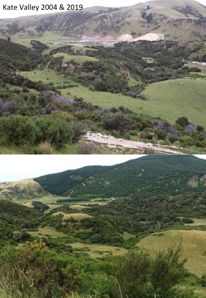
12 April                8.30am                 Gebbies Pass – Kaituna Valley  

P/U: Halswell

Alternative Route: A gentle climb through pine forest and farmland to the Packhorse Hut, descending to Kaituna Valley after lunch.

Standard Route:  As above, but continue along Mt Bradley Track for lunch before descending to Kaituna Valley.

Stats: distance 13km, ascent 560m, time 4hrs 40mins

 19 April                8.30am                 Greta Valley  

P/U: Woodend

Standard and Alternative Routes: Tramp over undulating North Canterbury farmland with moderate ascents and descents.

Stats: distance 15km, vertical ascent 528m, time 4hrs 30mins.

26 April                 8.30am                 Camp Saddle                         NB Late return – 5.00pm

P/U: Yaldhurst

Standard Route: Approach via the Broken River Ski Field Road, then climb to Camp Saddle. Walk along ridge then down the scree slope and return to the bus.

Alternative Route: Walk along the track to Lyndon Saddle and up Helicopter Hill. Return to the saddle then back to Broken River via the Craigieburn Track.

Stats: distance 13.4km, ascent 853m, time 4hrs 50mins

03 May       **8:00**    Mt Barrosa, Stour River, Lake Clearwater    NB Late return – 5.30pm

P/U: Yaldhurst

Standard route: Steady climb to the top of the mountain, then return via same route.

Alternative route: 10km loop track around Lake Clearwater.

Stats: distance 7.8km, ascent 824m, time 4hrs 30mins

10 May                 8.30am               Lake Rubicon              Note: additional $10 entrance fee

P/U Yaldhurst

Standard route: Farm walk with an initial climb, then undulating before a short steep climb

to lunch overlooking the lake. Descend, then return via the Rubicon River flats.

Alternative route: As above but shorter route to the lake.

Stats: 400m, distance 13.7km (Alternates 11.8km), ascent 400m, time 4hrs 50mins

17 May                 8.30am               Omahu Bush to Hoon Hay Reserve 

P/U:  N/A

An easy to moderate ridge walk with some climbs and descents. Starting with Omahu Bush tracks before walking along the Crater Rim Walkway. Alternates doing a shorter loop in Omahu Bush. Lunch at Coopers Knob.

Stats: distance 13km, ascent 260m, time 3hrs 50mins     

24 May                8.30am                Mt Alexander                   NB Late return – 5:00pm   

P/U: Woodend

Standard Route: A steady climb on farm tracks to the summit and loop track back to the bus. Wonderful views.

Alternative Route: As above to the summit but returning via the farm tracks.

Stats: distance 15km, ascent 672m, time 4hrs 45mins

31 May                 8.30am                 Prebble Hill 

P/U: Yaldhurst

Standard route: Follow farm tracks across the river and to the ridge for lunch with spectacular views of Broken River Valley.  After lunch take the track down and follow the route to the bus.

Alternative Route: An easy walk over farmland and stock bridge, followed by a steady climb through tussock to limestone tors. Return the same way.

Stats: distance 10.1km, ascent 298m, time 4hrs

07 June                8.30am                  Tree Planting followed by a walk.  

This will be around the Summit Road area with details to be advised later.

14 June                 8.30am                 Mt Richardson               NB Late return – 5.30pm  

P/U: Ohoka Road Silverstream between Island Rd and Silverstream Blvd

Standard Route: Climb Mt Richardson track to the trig station at the summit, then continue east along Blowhard Track and down the Bypass track.

Alternative Route: Ascend Mt Richardson track as far as is comfortable and return via the same route.

Stats: distance 12.4km, 660m, time 5hrs  

21 June                8.30am                 Little River to Birdlings Flat 

P/U: Halswell    

Standard Route: A road walk with steady climb to the ridge, along Bossu Rd and down to Birdlings Flat.

Alternative option: As above but starting at the top of Kinloch Road.

Stats: distance 17.7km, ascent 600m, time 4hrs 20mins

28 June                8.30am      Princess Margaret Hospital to Huntsbury 

P/U: PMH

Moderate climbs and descents on streets and tracks through Victoria Park to Sugar Loaf and Huntsbury.

Stats: distance 14km, ascent 440m, me 4hrs 50mins


The annual birthday lunch will be held on 5 July. Details will be provided nearer the time.

Tiromoana/Kate Valley 11 Jan 2023

Leader Mentor Understudy Tail Ender
Standards Peter Tony Bev Ailsa
Alternates Norma Ali Gary G Tessa

Distance (approx)12km; duration 4hrs 25min; vertical ascent 424m

The first tramp of a new year 23 trampers and our driver Alan gathered at Bishopdale. This including two visitors Les (his third tramp with us) and Brent. We left a little early allowing us to pick up our final tramper (President Bev) at Woodend, stop for a necessary break at Amberley, and arrive at the tramp car park by 9:40.

As usual, the Standards left first with their hearty group of 11; the 13 Alternates followed shortly thereafter. For those who have never done this tramp, the bus parks at the top of a hill and we tramp down to the beach where we have lunch and then return. It’s a lovely and well-marked trail, albeit with the ascension/descension parts reversed from most of our tramps.

Transwaste Canterbury operates the Kate Valley Landfill adjacent to the Bush area. It funds the conservation project with the goal to regenerate a 407-hectare lowland native forest at Tiromoana Bush through which we tramp. This link contains pictures of Kate Valley in 2004 and 2019; Kate-Valley.jpg (720×1040) (transwastecanterbury.co.nz) The changes are obvious.

The weather was drizzly, and most donned rain jackets and sweaters before starting off.  The Alternates caught up with the Standards at the designated morning tea spot, neither group staying all too long with the drizzle. The Tiromoana Bush Track is truly undulating which keeps the legs in good working order. The route taken by the Alternates can be seen on the map from the following link (from car park to 2, left to the toilet symbol and then down to 9, 8, Te Ara Kanuka track to 6, 5, and finally 4): Tiromoana Bush Walkway – Transwaste (transwastecanterbury.co.nz).

The Standards took the same route except they continued past Te Ara Kanuka cutoff to Ella Peak. They dropped their packs at the turnoff for the 30-minute return side trail described as “not easy due to some steep parts but the view from the top across the Canterbury Bight to the Port Hills makes it worthwhile”. (Peter Moore)

The Alternates arrived at the beach at 11:50 after crossing a small stream four times. The Standards arrived just as the Alternates began their journey back up to the bus. Some discussion was had whether the return should be via the road (shorter but steeper and shown as the northernmost branch of the Track on the map above) or whether we should retrace our tracks and then taking Te Ara Tawhal track which would have been longer but not as steep. The decision was to do the former leading to the Alternates reaching the bus by 2; the Standards arrived shortly thereafter.

Due to dampness, we did not stop at Amberley, but headed back to Bishopdale after another good day’s tramp.

Text by Michele S

Tramping Programme 11 January – 29 March 2023

The cost of all tramps is $20  

11 January     8.30am     Kate Valley – Tiromoana Bush Walkway

P/U: Woodend

Standard route:  An undulating descent through Tiromoana wetlands and farmland. Detour from the wetlands track to climb Ella Peak before continuing to the beautiful Pegasus Bay beach for lunch. Steady ascent along a shingle road to the bus.

Alternative route:  As above, except for the climb to Ella Peak.

Stats: distance 12.8km (alternates 11km), vertical ascent 424m, time 4hrs 25min.                

18 January     8.30am     Evans Pass – Sign Of the Kiwi – Sign of the Bellbird

P/U: N/A

An open, grassy ridge climb with some rock-hopping to start and then ranging from easy to steeper climbing and descent sections.

Standard route:    Crater Rim walkway from Evans Pass to the Sign of the Bellbird.

Alternative route: Crater Rim walkway from Evans Pass to the Sign of the Kiwi.

Stats 17km, vertical ascent 410m, time 5hrs 40mins.

25 January     8.30am     Weka Pass Farm

P/U: Woodend

Both groups walking together. An initial short climb and descent through farmland, followed by undulating farm tracks and walking on the disused Old Weka Pass Road. Spectacular limestone country.

Stats: distance 14km, vertical ascent 474m, time 4hrs 30mins.

1 February     **8:00am**     Mt Alford

P/U Yaldhurst   

Standard route: Steady climb through Alford Reserve beech forest, tussock country and then sub-alpine scrub to top of Mt Alford. Great views. Return via same route.

Alternative route: Same as above climbing as high as able, followed by side trip through Alford Forest Scenic Reserve.

Stats: distance 9km, vertical ascent 730m, time 4hrs 45mins.

8 February     8.30am     Pigeon Bay Walkway

P/U: Halswell

An easy walk following a shingle road and then a narrow track over grassland. The walkway follows the eastern side of Pigeon Bay towards the head of the bay and has moderate undulations with good views of the bay, coast and sea.

Stats: distance 14km, ascent N/A, time 4hrs 30mins.

15 February     8.30am     Rabbit Hill – Trig M Hill

P/U: Yaldhurst

Steady uphill grades through tussock then descend to the saddle and via the Transmitter Hill track to the bus.

Stats: distance 10km (alternates 8.6km), ascent 1105m, time 3hrs 45mins.

22 February     8.30am     Okuti Valley, French Peak

P/U:  Halswell

Out from Little River, a farm walk with steady inclines to a saddle where the Alternates can stop for lunch while the Standards head up French Peak.

Stats: distance 14.8km, ascent 720m, time 4hrs 30mins.

01 March     8.30am     Sumner-Taylors Mistake-Evans Pass

 P/U and meeting point: Clocktower Scarborough. Alternates taken to Evans Pass.

Standard route: Walk over Scarborough to Taylors Mistake, Boulder Bay, Godley Head and out to Evans Pass.

Alternative route: Walk reverse of Standards from Evans Pass  to Scarborough. There is only one major climb from Taylors Mistake over Scarborough Hill though can take a shortcut down the Annaconda track from Breeze Col or go all the way to Godley Head and around.

Stats: distance 14km, ascent not recorded, time 4hrs.

08 March     8.30am     Dalethorpe to Annavale

P/U: Yaldhurst

Both groups:  A steady climb on farm tracks to a wonderful viewpoint on the Russell Range for lunch. Descend to Annavale airstrip alongside SH 73.

Stats: distance 14.1km, ascent 383m, time 4hrs 15mins.                                

15 March     8.30am     Hogsback Track – Castle Hill

P/U: Yaldhurst

Standard route: Tramp along an undulating mountain bike track from Castle Hill Village to the western end of Hogsback Ridge. After lunch on the ridge and return along the same track.

Alternative route: As above but stopping for lunch along the track as suits.

Stats: distance and ascent yet to be recorded, time 5hrs.

22 March     **8.00am. Return 5.30pm or later.   Rangitata Gorge Walkway

P/U: Yaldhurst

Standard route: A short climb to the river terrace above the scenic gorge, then on an undulating farm track until descent to the river edge. Wonderful views of the river gorge.

Climb to Gunsight Pass for lunch stop. Return via the same route.

Alternative route: As above, except stop for lunch near the river, then return.

Stats: distance 12km, ascent 298m, time 4hrs 15mins.

29 March     8.30am     Coalpit Spur

P/U: Yaldhurst  

A tramp in the Craigieburn Forest Park..

Standard Route: up Mistletoe track to the ridge then down Craigieburn Road and drop

down Coalpit Spur.

Alternative Route: around Sidle 73 track before descending the Coalpit Spur track.

Stats: distance 14km, vertical ascent 612m, time 4hrs.